Brooks Falls – Katmai National Park

Brooks Camp Ranger Station

The location is legend.  Mention Brooks to a wildlife photographer, even the most rank beginner, and the response will be that they have either been there, or are planning a visit, or dreaming about a visit.  There is simply nothing else like viewing brown bears from the wildlife viewing platforms near the falls of the Brooks River.

Under favorable circumstances, you will visit perhaps ten or more big Alaska brown bears feasting on a lively run of salmon.  You will gain an appreciation for the dedication these bears have for consuming salmon, and the industry with which they pursue their efforts – these animals are not messing around, this is survival.  You will witness bears in close proximity, which invariably leads to intimidation behavior, feinted attacks, and occasionally outright extreme violence.  All of this happens within 100 feet of the viewing platform.

Brooks Falls, Katmai National Park, AK

To be sure, a visit to Brooks Falls is a genuine adventure.  Katmai National Park can only be reached by boat or plane.  If you arrive too early in the year, or too late, or if for any reason the salmon are not in the Brooks River, there will be no bears.  In this case, you will have traveled to a moderately picturesque spit with notoriously lousy weather just to visit with the Park Rangers.  Don’t get me wrong, the Rangers at Brooks Camp are amongst the best in the system, but you are there to see the bears.

The Alaskan portion of your journey will most probably begin with your arrival at Anchorage, and almost certainly by plane.  From Anchorage, you will need to get to one of several more remote locations that lie within float-plane range of Brooks Camp, which is the administrative unit that oversees the business of managing visitors to Brooks Falls.  Homer is a popular departure point, and although Homer is an interesting place to visit in and of itself, the flight from there is longer than from several other locations.  For our visit we choose to stay in King Salmon, AK, which is home to a number of adventure lodges that serve both wildlife enthusiasts and fishermen.

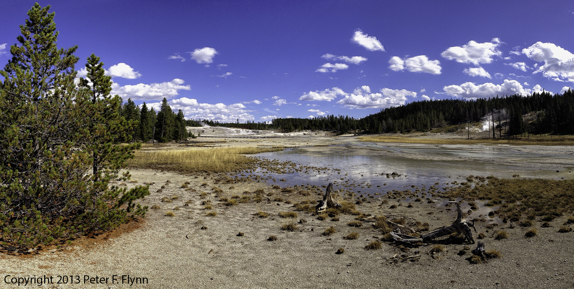
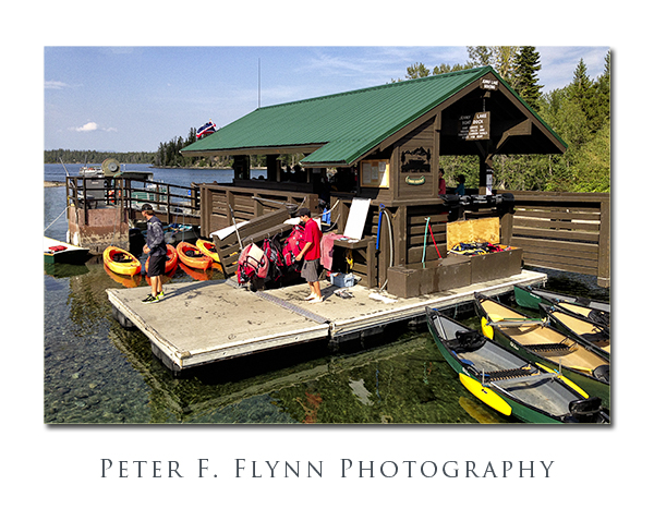
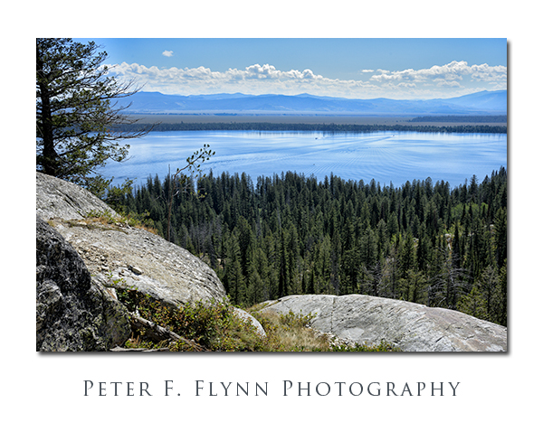
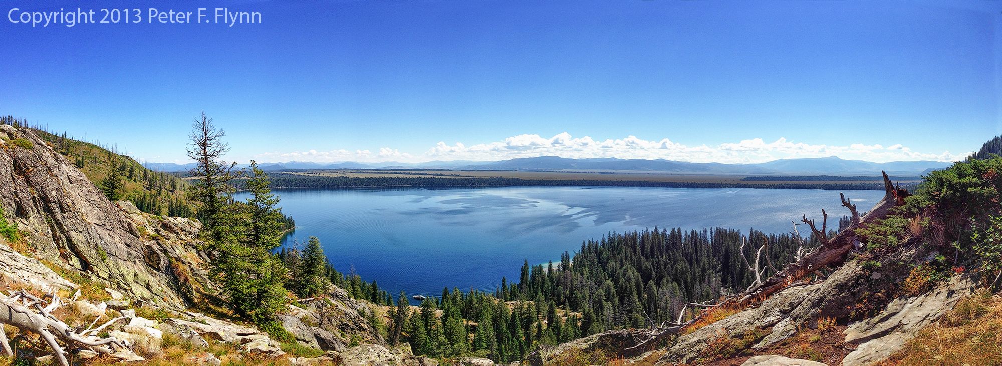
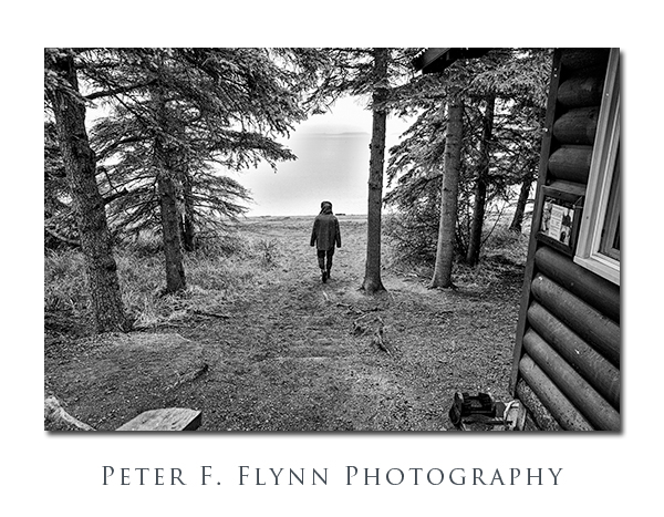
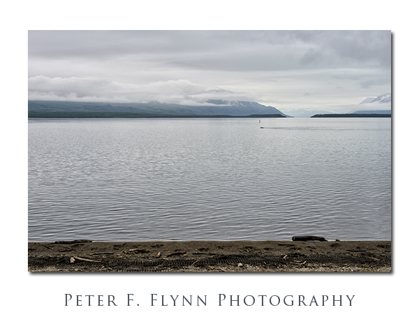
The image below shows the view eastward from Brooks Camp on the western shore of Naknek Lake.  Most visit to Brooks Falls begin here.

Naknek Lake from Brooks Ranger Station
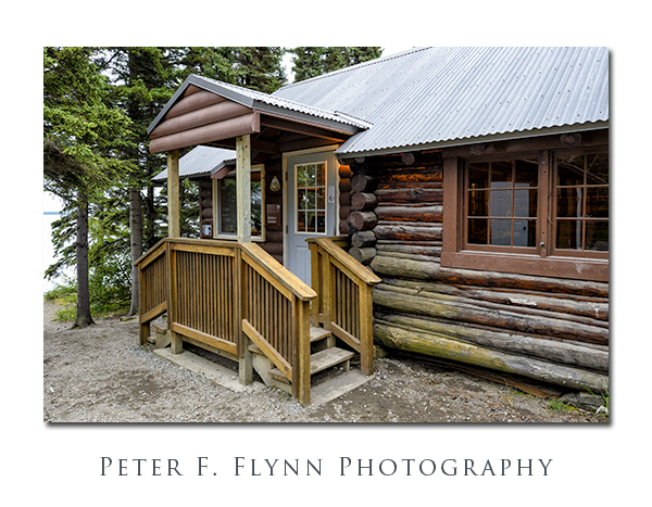
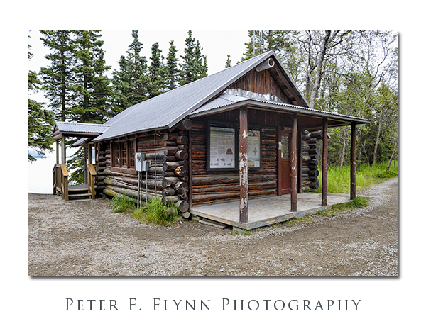
Brooks Camp consists of the Ranger Station, a lunch kiosk, a camping area, a lodge and cabins, and a small general store.   If you have arrived by boat or float plane for a day visit, you will immediately want to visit the ranger station.  Here you will need to check in and schedule an orientational seminar (see below).  The seminar is held inside of the ranger station, and  is mandatory for entry onto the bear viewing platforms.

Brooks Camp Ranger Station

Brooks Camp Ranger Station
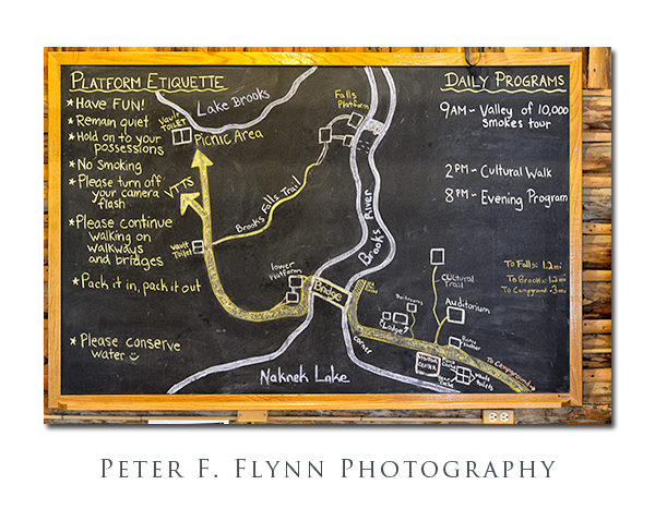
A large map in the seminar room (see below) provides an overview of what the rangers present during the seminar.  There are two platform complexes, the Lower Platform at the west end of the floating bridge, and the (main) Falls Platform.  The Falls Platform itself has two sections, one of which (upper) is directly adjacent to the Brooks Falls, and a another (lower) section that is a 200 meters or so downstream.  You must make an appointment to access the upper section, but access to the lower section is on a first-come basis. The rangers staff the platforms and regulate entry.

Map of Brooks Camp

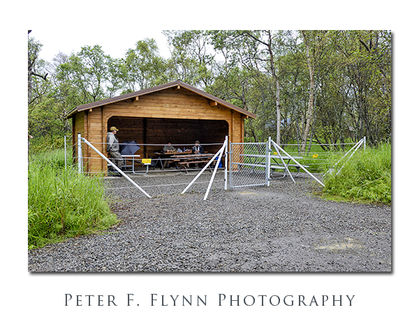
An enclosed lunch area is located just west of the ranger station – see two images below.  The shelter is surrounded by an electrified fence – a neat reminder of where you are.

Picnic Shelter at Brooks Camp

Brian and the HP in the Picnic Shelter

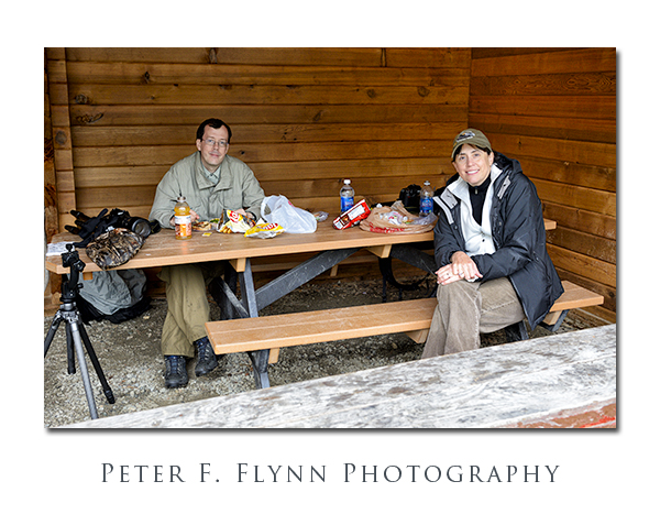
The HP and Brian enjoy their lunch in the enclosure (above).  Most guided tour outfits provide a pack lunch.

To get to the wildlife viewing platform, you travel south from the ranger station along a path that passes by the lodge and general store.  Meals are served to the general public at the lodge commissary.  After several hundred meters you encounter the floating bridge, which is a major junction along the way to the Falls.

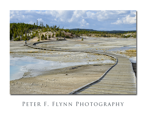
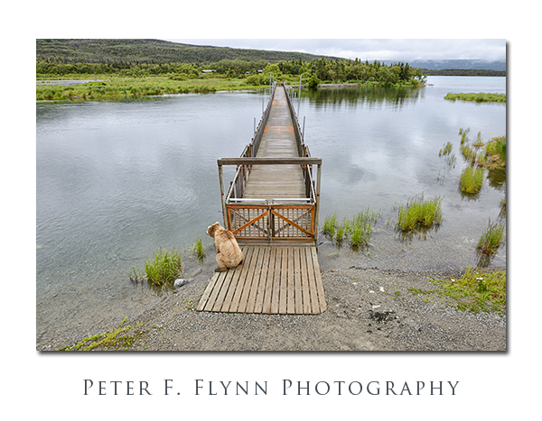
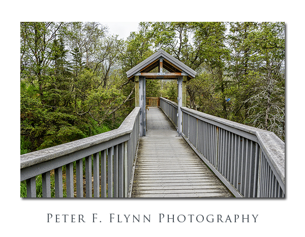
The image below was shot from the Lower Platform northward across the floating bridge.  The bridge is continuously monitored from both sides by Park Service Staff.  The presence of bears on either side leads to a temporary closure –  bears frequent this area and the wait for a crossing can be 30 minutes or more…it depends on the disposition of the bear.

PFF_D4_20120726_0808_NX2_Framed

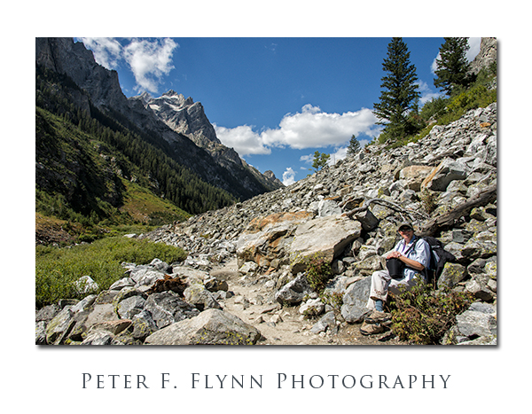
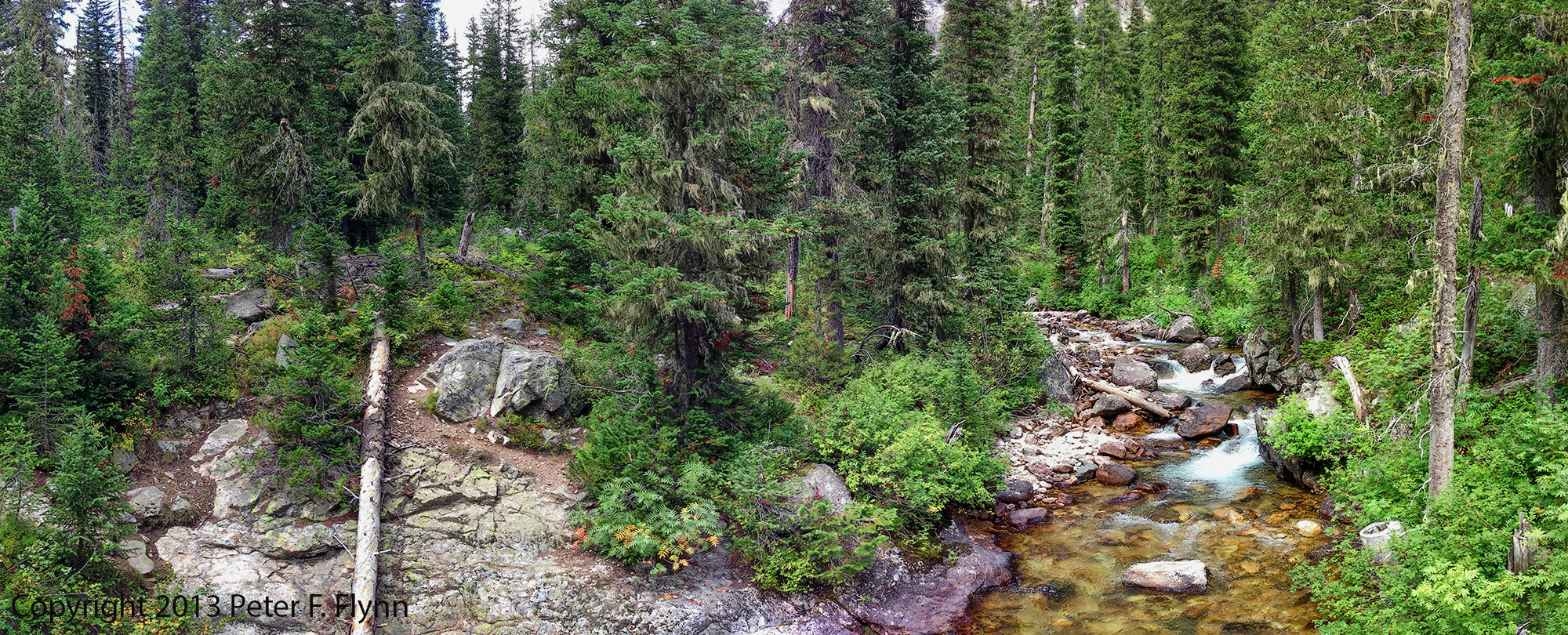
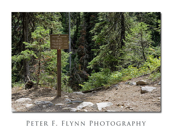
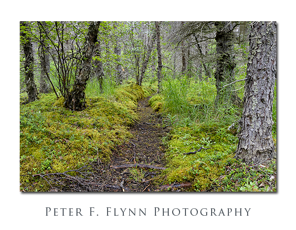
Beyond the floating bridge the path follows a gravel road west.  Griz can appear anywhere along the way and constant vigilance is required.

Brooks Falls, Katmai National Park, AK

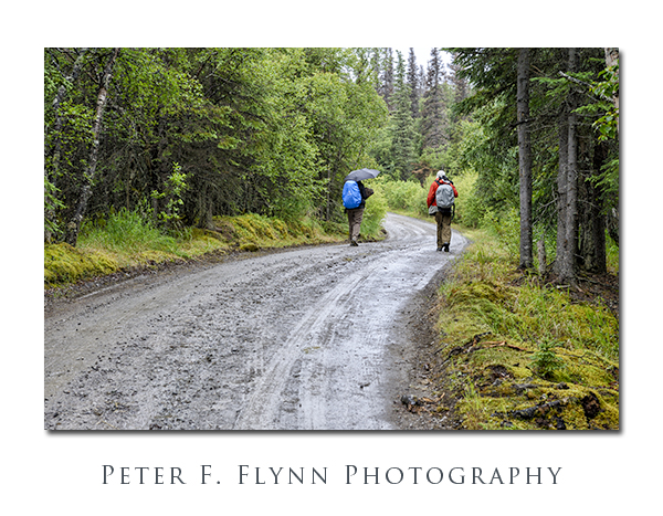
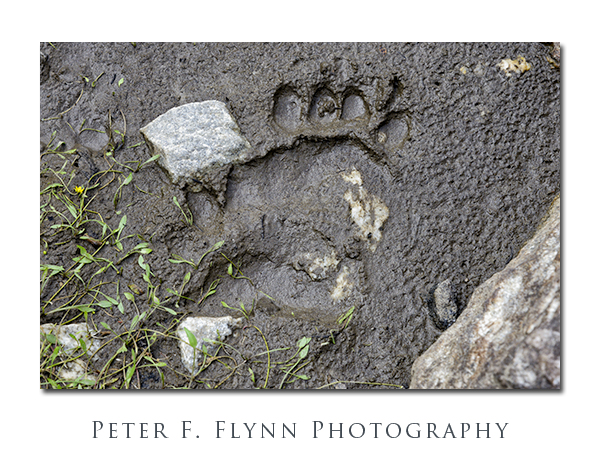
The image below shows one of the many well-worn bear paths that intersect the main pathway.

Brooks Falls, Katmai National Park, AK

Below, the HP and Brian prepare to access the south gate of the Falls Platform complex.

Brooks Falls, Katmai National Park, AK

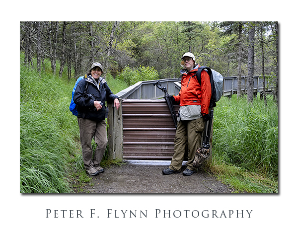
The image below shows one of the gates along the elevated platform at Brooks Falls.  These gates are designed to regulate human access to the platform – no chance that they could fend off a determined bear.

Brooks Falls, Katmai National Park, AK

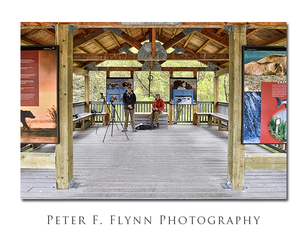
The image below shows the HP and Brian at the Fall Platform pavilion.  Rangers posted here regulate access to the upper section based on the time of your appointment.  From here you can also freely access the lower section of the platform.

Brooks Falls, Katmai National Park

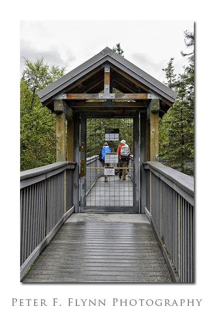
 One last gate brings you to the main Falls Platform.

Brooks Falls, Katmai National Park

You first glimpse of the platform gives you a read on how crowded it will be.  There are two decks, each with space for about 10 shooters – if everyone plays nice…

Brooks Falls, Katmai National Park, AK

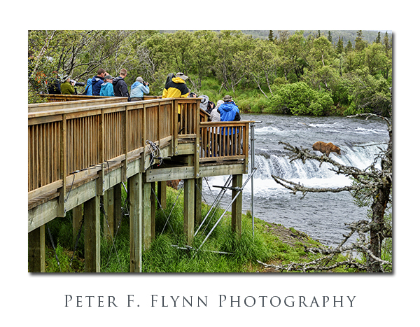
Excitement builds as you approach the viewing platform – not too crowded today, excellent!

Brooks Falls, Katmai National Park, AK

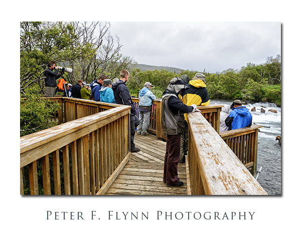
The shot below was made from the upper portion of the platform.  If you are stuck in the back, a long tripod and something to stand on can improve your shooting perspective.  If you are hand-holding you can usually find a slot to aim through.

Brokks Falls, Katmai National Park, AK

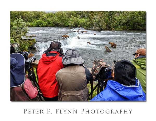
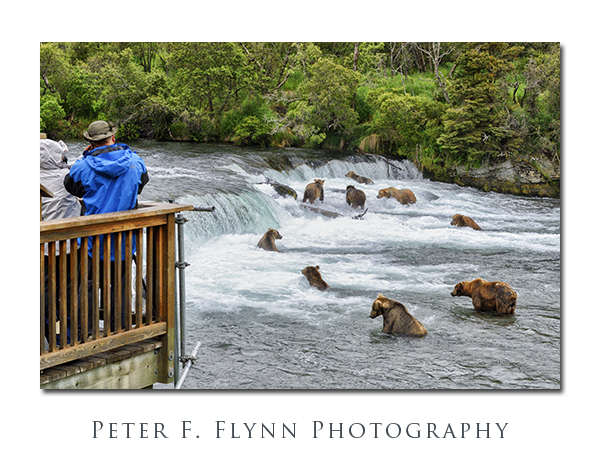
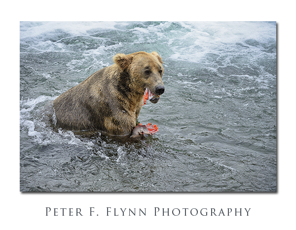
And finally, after long travels and after securing a sweet spot on the platform, the bears!

Brooks Falls, Katmai National Park, AK

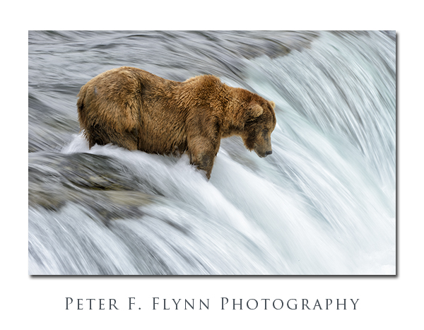
To get the flowing water look above, I shot at 1/20s.  You need to be patient, and also make a lot of shots – the bears move around quite a lot, and getting an acceptable image is a little challenging.

Brooks Falls, Katmai National Park, AK

Brooks Falls, Katmai National Park, AK

Brooks Falls, Katmai National Park, AK

Brooks Falls, Katmai National Park, AK

Brooks Falls, Katmai National Park, AK

Brooks Falls, Katmai National Park, AK

Brooks Falls, Katmai National Park, AK

PFF_D4_20120726_1918_NX2_Framed

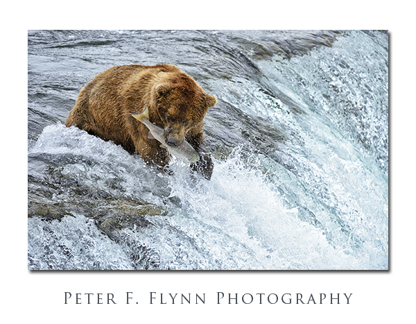
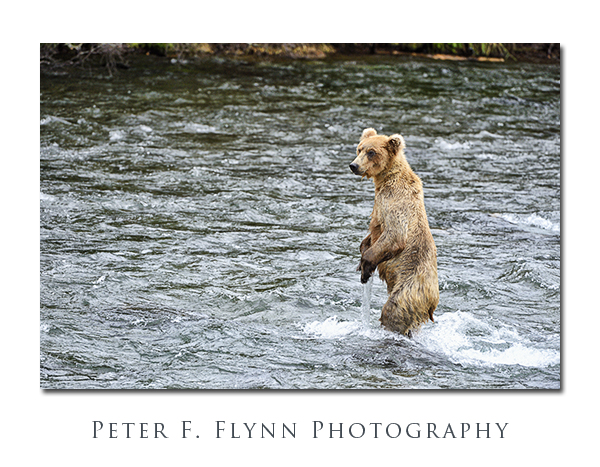
Images in this entry were recorded on July 26, 2012, using the Nikon D4 and the AF-S NIKKOR 200-400mm f/4G ED VR II at various focal lengths.  Exposure was mostly f/5.6 and 1/1000s, ISO at 2000.  ITTR used, corrected in conversion using Nikon NX2.

Copyright 2014 Peter F. Flynn.  No usage permitted without prior written consent. All rights reserved.


Porcelain Basin

Norris Geyser Basin

Norris Geyser Basin is a large geothermal area that lies near the conjunction of park roads that head south to Madison, east to Canyon village, and north to Mammoth Hot Springs.  Norris, as park denizens refer to it, is divided into three major areas by a trail system that depends largely on boardwalks: Porcelain Basin, Back Basin, and Back-of-the-Back Basin.  Back Basin and Back-of-the Back Basin are collectively labelled just Back Basin on Park maps, but visitors are likely to appreciate that these two areas are quite easily distinguished by the distinct levels of effort required to explore them.

Norris Geyser Basin

The most accessible, and in my view, the most rewarding area in Norris is Porcelain Basin.  I will post an entry on Back Basin in the future, but this entry will focus exclusively on the quite easily manageable circumnavigation of Porcelain Basin.  The area is located just north of the Norris Geyser Basin Museum, which itself is about 300 meters west of the parking area along a paved pathway.

Yellowstone National Park, Fall 2013

 Click on pano thumbnail above to view larger image

Yellowstone National Park, Fall 2013

 Click on pano thumbnail above to view larger image

n

Norris Geyser Basin

The two images above were recorded looking west from the paved trail that descends from the museum.

Norris Geyser BasinA warning to photogs along the descending pathways…  Prodigious quantities of steam are continuously produced by the Ledge Geyser.  The winds within the basin are characteristically changeable, and one can find themselves enveloped within a steam cloud instantly, virtually any time morning or afternoon.

Norris Geyser Basin

The route leads north down from the museum along a paved path that provides an excellent overview of Porcelain Basin.  After descending perhaps 50 meters, hikers encounter a fork in the path.  I suggest traveling along the east (right) leg, which places one on an anti-clockwise orientation around the basin.  Much of the route around the basin consists of a boardwalk in very good condition.  Guardrails provide an extra element of safety if you are totting children, but are also useful for leaning against while studying the terrain.

Norris Geyser Basin

A bit of backtracking is required if you wish to visit all of the major geothermal features in the basin.  I would highly recommend taking the extra time to visit Colloidal Pool, Hurricane Vent, and Porcelain Springs, all of which lie on an eastern spur of the main route.

Norris Geyser Basin

Yellowstone National Park, Fall 2013

 Click on pano thumbnail above to view larger image

Yellowstone National Park, Fall 2013

 Click on pano thumbnail above to view larger image

Yellowstone National Park, Fall 2013

 Click on pano thumbnail above to view larger image

The name Porcelain Basin derives from the delicate white color of the mineral deposits in the area.  The light color of the surface contrasts with the stronger colors produced by the other mineral deposits, and from the colorful algae and bacteria that exist in the relatively hostile conditions found here.

Norris Geyser Basin

The main route leads north, bold and straight across Porcelain Basin.  The obvious, low-impact, route would have followed the high ground (east) around the circumference of the basin.  I can only guess that the current route was forged in early times, as environmental impact would appear to be maximized with the existing situation.  I have no idea how the boardwalk maintenance can be executed…  Regardless, the boardwalk is wide and stable.

Norris Geyser Basin

But in some parts of the basin the stream bed is green!  Really green…  This unlikely hue is due to the presence of Cyandium caldarium, an algae that exists only in environments with a pH between 0.5 and 5.0, and water temperatures between 35C and 55C.  Yeah, think hot acid solution.

Norris Geyser Basin

Norris Geyser BasinNorris Geyser Basin

You are unprepared for the intensity of the color and contrast.  We have scoured the earth for kooky natural phenomenon.  This is as good as it gets, just stunningly beautiful.

Yellowstone National Park, Fall 2013

 Click on pano thumbnail above to view larger image

The return side of the route provides a compelling view of the descent into the basin and the crossing.  Pick a time in the afternoon to walk the route and you will be rewarded with favorable light along the entire route.

Norris Geyser Basin

Norris Geyser Basin

Images in this entry were recorded on the afternoons of the September 21, 2012, and September 29, 2013, using the Nikon D800 and D800E at f-stop at f/11 or f/16.  Panoramic images were recorded using the Apple iP5 and the Autostitch acquisition application.

Copyright 2014 Peter F. Flynn.  No usage permitted without prior written consent. All rights reserved.

Inside the Tetons

All in all, Grand Teton National Park is arguably the most accessible of the big nature parks.  It is a manageable drive from Bozeman or Salt Lake City, or of course just about any place in Idaho.  Alternatively, you can fly literally right into the park, since landing in Jackson Hole Airport places you within park boundaries.  With Grand Teton NP you get the big views right from US Highway 89 (aka US 26), and indeed, it is enough for most folks just to stop at the overlooks and scope the mighty Teton massif.

Jenny Lake Boat Dock

If you are the adventurous sort however, you may be compelled to explore the Tetons at closer range.  There are a variety of options to satisfy your curiosity about what lies within the range.  From the highway, the range may seem to be perfectly impenetrable, but in truth there are a number of routes that lead you deep into the heart of the granite wilderness.

Three major park trails lead up and into canyons that penetrate the Teton range.  From north to south they are the Paintbrush Canyon Trail, which begins at the Leigh and String Lakes Trailheads; Cascade Canyon Trail, which begins at the western side of Jenny Lake, near the shuttle boat dock; and the Lupine Meadows Trail, which leads into Garnet Canyon.

The HP on the Ride to Cascade Canyon

Clearly the most popular, and in my view, the best choice, is the path through Cascade Canyon.  This choice has the advantage of allowing the intrepid visitor the opportunity to incorporate the unique experience of the ride on the Jenny Lake shuttle boat to the start of the trail.

Cascade Cayon

A short walk (0.6 miles) from the mouth of the canyon at the shore of Jenny Lake brings you to the Hidden Falls of Cascade Creek (above).  Cascade Creek will  be your faithful companion as you travel into Cascade Canyon and into the midst of the Teton peaks.

Bridge Over Cascade Creek

A number of bridges transverse back and forth over Cascade Creek.  All of these structures are built in that old-world WPA/CCC/NP style that conveys timelessness – built one time, the right way, for all time.

Cascade Canyon

The trail past Hidden Falls ascends through several steep switchbacks built into the granite slope.  About 0.4 miles past Hidden Falls (1 mile total) and 400 ft of elevation gain (from the boat dock) along the Cascade Creek trail, brings you to Inspiration point.  Views from the point are shown above and below.

PFF_iP5_20130825_0065_Crop_4_blog

Click on pano thumbnail above to view larger image

From Inspiration Point, looking east, you can watch the shuttle boats crossing Jenny Lake every quarter-hour.  For some, the walk up to the point is as far as they are compelled to venture.  There is more to see however, much more.

Cascade Canyon

The route veers west, away from the point and into Cascade Canyon proper.  The walk begins in forest, but emerges into the open after about a quart of a mile and another 200 ft of elevation.  Below, the HP takes in the scenery, including Mount Owen shown in the background.

HP in Cascade Canyon

The path into the Tetons leads westward along Cascade Creek through meadows and across granite scree fields.  The path is virtually flat from this point onward all the way to the forks (see below).

PFF_iP5_20130825_0066_Crop_4_blog

Click on pano thumbnail above to view larger image

Cascade Canyon

Even though you are quite literally right below the major summits of the Teton Range, including Grand Teton and Teewinot, the depth and shape of the canyon prevent a view of most of the peaks.  The exception is Mount Owen, shown above, which lies north and west of the other peaks.

Bear Paw Print in Cascade Canyon

The lush flora present in Cascade Canyon invites all sorts of wild life, including pika, chipmunks, marmots, moose, squirrels, and the rarely sighted pine marten.  And yes, this is bear country, the evidence of which is shown above.   Travel into Cascade Canyon only with bear spray rigged in a ready-to-deploy condition.

Cascade Canyon

At several points along the trail, Cascade Creek meanders a bit, forming small lakes.  Here grasses, bushes, and trees grow thick and tall (see above and several below).

PFF_iP5_20130825_0069_Crop_4_blog

Click on pano thumbnail above to view larger image

Cascade Canyon

PFF_iP5_20130825_0072_Crop_4_blog

PFF_iP5_20130825_0070_Crop_4_blog

Click on pano thumbnails above to view larger images

Cascade Canyon

The forest closes in on Cascade Creek near the western end of the canyon.  By the time you reach the junction with the South Fork Trail, you are walking through dense forest.

PFF_iP5_20130825_0073_Crop_4_blog

Click on pano thumbnail above to view larger image

Capitol Domes from the Notom Road

A clearing marked with the signpost* shown above confirms that you have reached the forks of Cascade Canyon.  From here, you can travel northwest another 2.7 miles along Cascade Creek to Lake Solitude.  Alternatively, you can travel along the South Fork to Hurricane Pass, with views of the Teton summits and Schoolroom Glacier.

We decided to turn around at the junction, having overheard that the trail up to Lake Solitude was rough and steep – happy to leave this for a day with an earlier start.

Full-frame images in this entry were recorded on August 25, 2013 between 10:30 and 16:45, using the Nikon D800 with the AF-S NIKKOR 24-120mm f/4G ED VR (mostly at 24mm).  Exposures were either f/11 or f/16, with shutter speed from 1/160s to 1/640s, ISO 1600.  Panoramic images were recorded using the iPhone 5 with the Autostitch application.

*The sign reads:

Cascade Canyon Trail

Jenny Lake – West Shore Boat Dock 4.5 <=

String Lake Outlet Parking Area 6.2 <=

Jenny Lake Outlet Parking Area 6.5 <=

Copyright 2013 Peter F. Flynn.  No usage permitted without prior written consent. All rights reserved.