Archive for the ‘Geological Curiosities’ Category

Valley of Fire

Click on pano images to view larger images

 Valley of Fire State Park

Bit of a cliché name perhaps, Valley of Fire, but wholly appropriate.  Imagine fire turned to stone, indeed, that is what you will find here.  No doubt, one of the most spectacular geological curiosities on earth.  Yeah, make that compared to say, for example, Arches NP, Canyonlands NP, Vermilion Cliffs, or even the big hole, aka the Grand Canyon.  Yeah, it really is that good.  Remarkably, this unique area is part of the Nevada State Parks system.

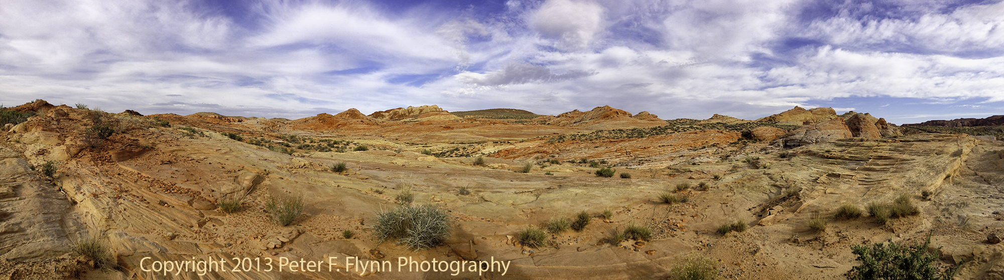
The image above was recorded on March 26 at 15:00 MDT, 2013, near coordinates 36,28.58°N, 114,31.63°W.

Valley of Fire State Park

Of course The Valley does not encompass as much area as some of the other awesome sandstone sites – somewhere between 34,000 and 42,000 acres (the park site does not list the area, and online sources provide inconsistent estimates).  For comparison, Vermilion Cliffs National Monument is over 290,000 acres…Grand Canyon is over 1.2 Million acres.  The park was not even chartered until 1935 – the fill of Lake Mead also began in 1935.  The Lake and Valley actually share a boundary, and since the former was made a National Recreation Area, it is interesting that The Valley remained under control of the State of Nevada.

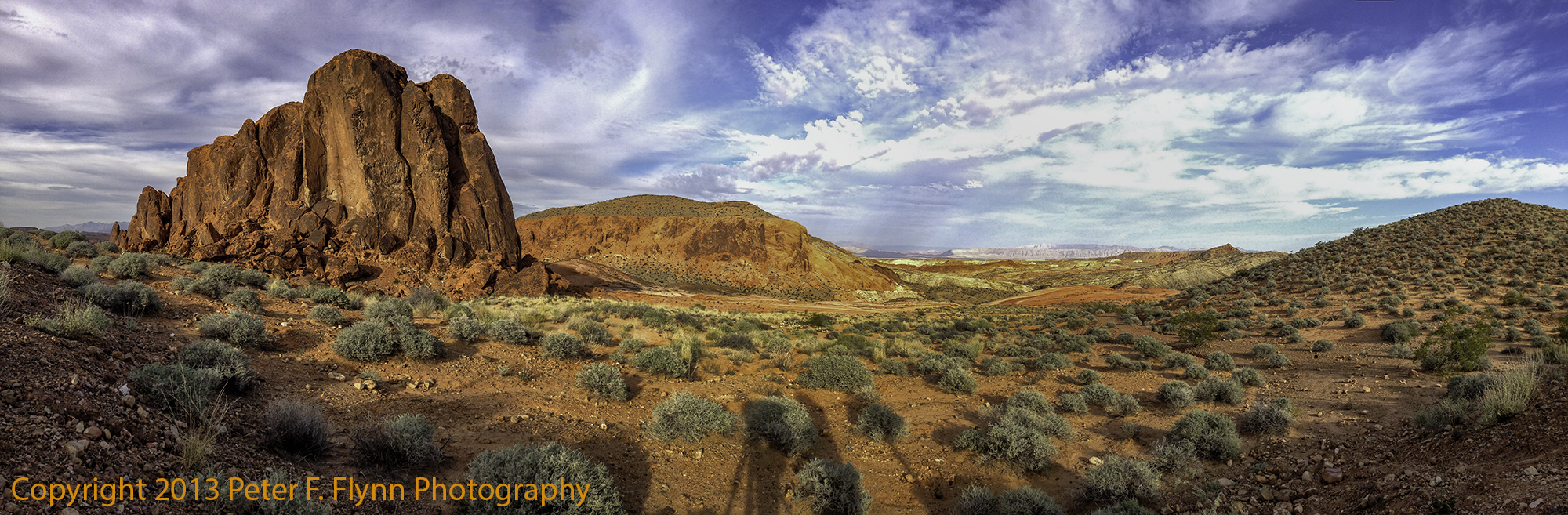
The image above was recorded on March 26 at 15:20 MDT, 2013, near coordinates 36,29.19°N, 114,31.58°W.

Valley of Fire State Park

There are two major roadways in the park.  The main highway, aka The Fire of Fire Highway, runs east-west, while Mouse’s Tank Road runs north from the junction with the highway.  The roads are very well maintained, with frequent opportunities to stop safely along the way.

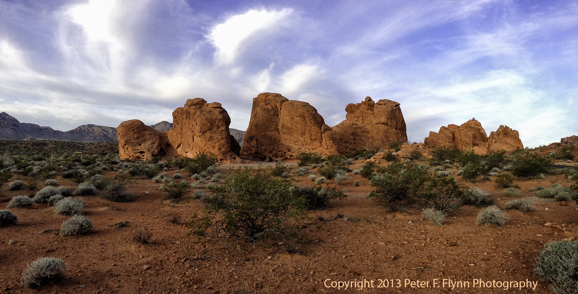
The image above of the Seven Sisters was recorded on March 27 at 07:13 MDT, 2013, near coordinates 36,25.59°N, 114,30.02°W.

Valley of Fire State Park

The park is about 55 miles northeast of Las Vegas along I15, exit 75.  Amongst the unusual features of the park is the active wedding photo biz that is supported.  On a typical day, one can view about a dozen wedding photo shoots – big limousines and large wedding parties included…

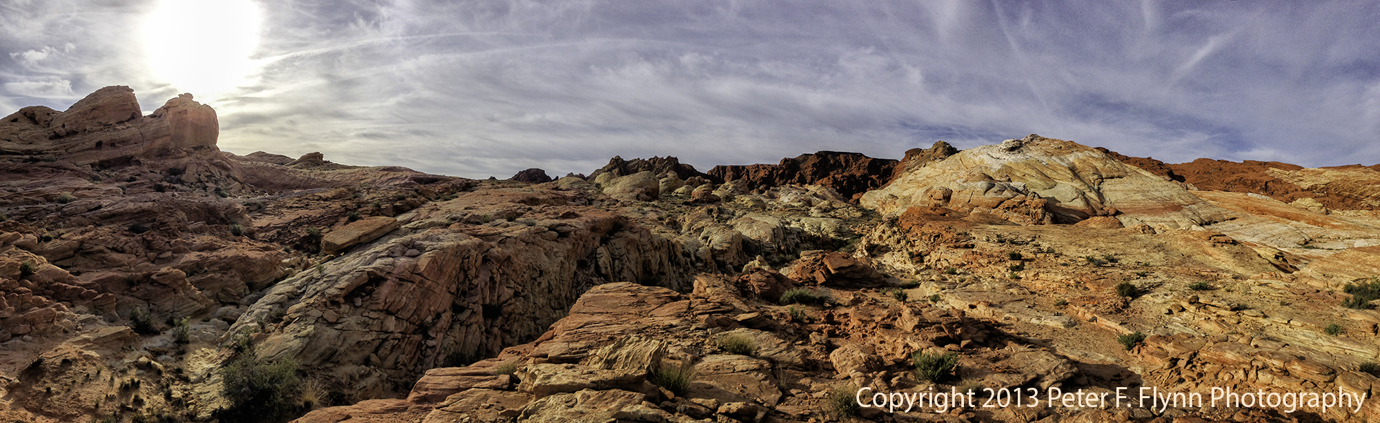
The image above recorded on March 27 at 08:20 MDT, 2013, near coordinates 36,27.74° N, 114,31.46° W.

Valley of Fire State Park

Most of the visitors stick close to the main highway and visitors center area.  Even on busy days the north end of the park remains relatively uncrowded.

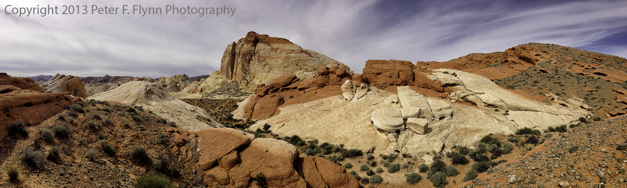
The image above was recorded on March 27 at 10:36 MDT, 2013, near coordinates 36,29.18°N, 114,31.79°W.

Valley of Fire State Park

Although this is a small park by NP standards, it is super-rich with image-able features. and deserves at least a full day shoot – frankly, two days minimum to shoot it properly.

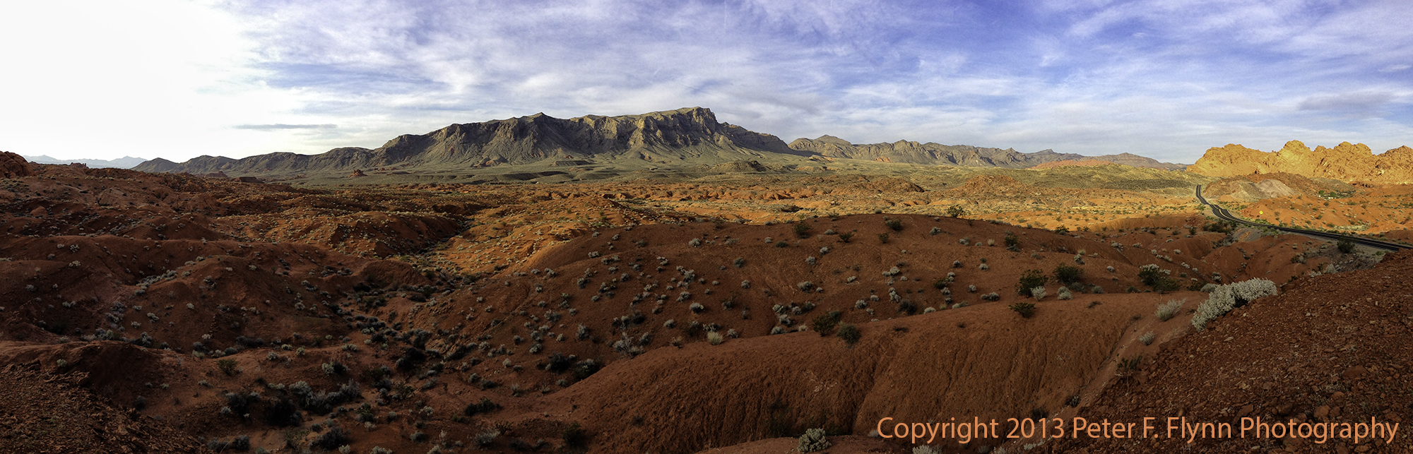
The image above was recorded on March 28 at 07:30 MDT, 2013, near coordinates 36,25.55°N, 114,27.85°W.

Valley of Fire State Park

Some may claim that the images in this entry have been over-amp’d.  Nah, not at all, in fact if anything, I have been a bit too light on the processing.

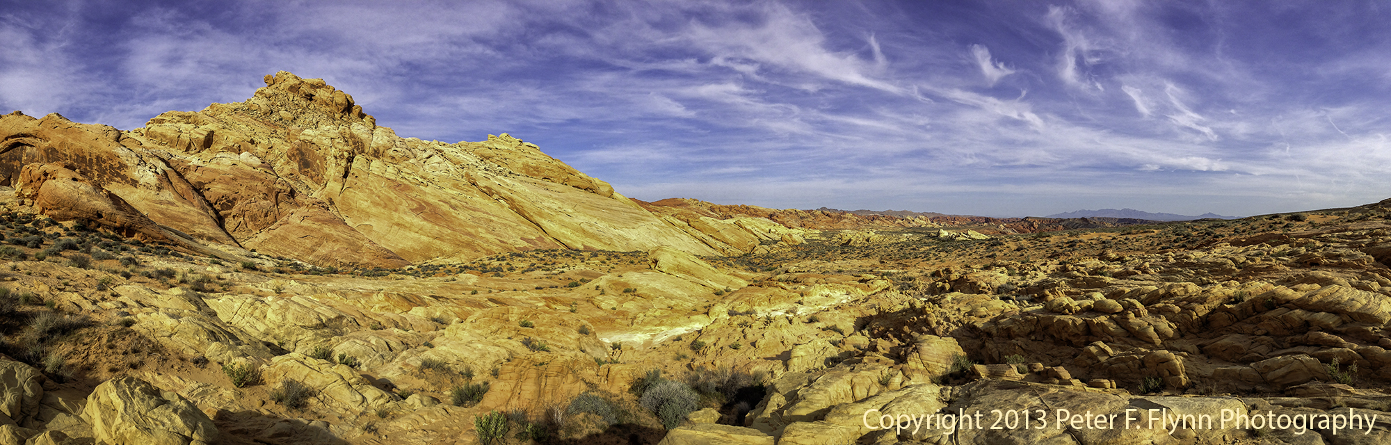
The image above was recorded on March 28 at 08:44 MDT, 2013, near coordinates 36,27.12°N, 114,30.95°W.

Valley of Fire State Park

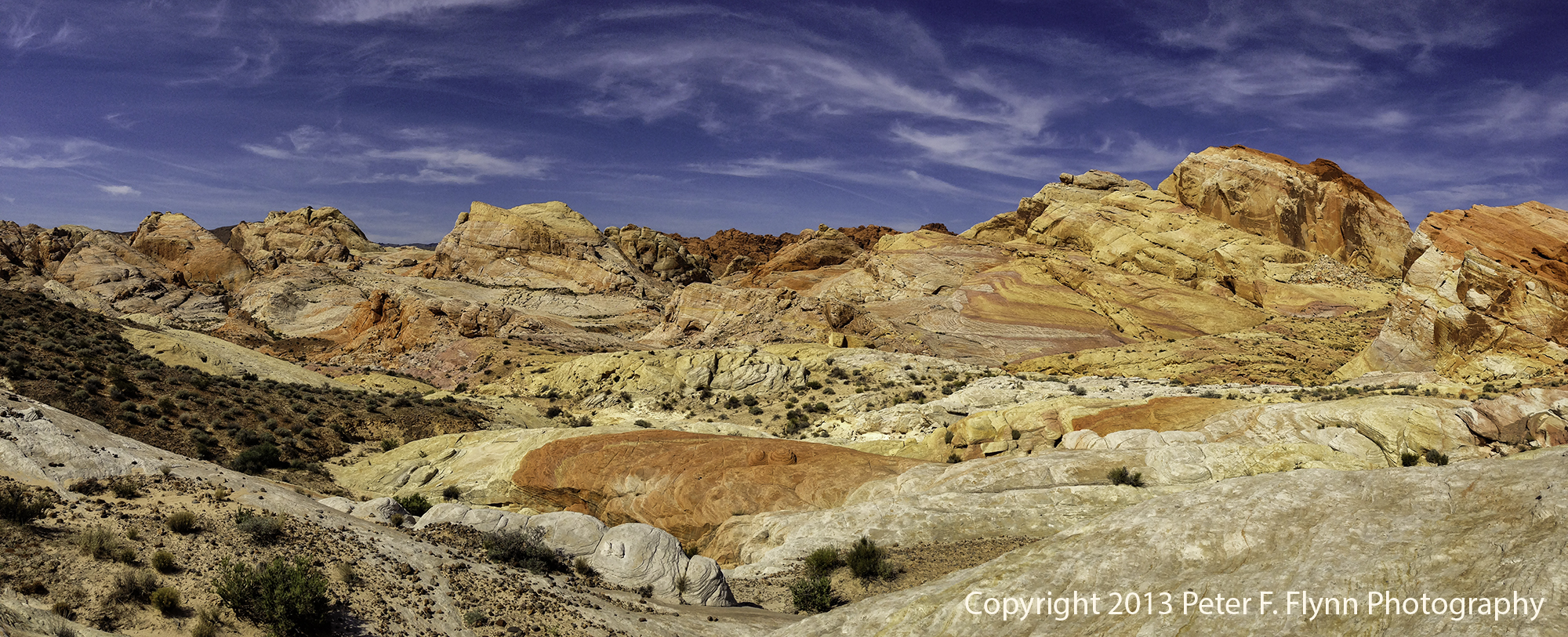
The image above was recorded on March 28 at 10:37 MDT, 2013, near coordinates 36,28.95°N, 114,31.70°W.

Images in this entry were recorded on March 26 through March 28, 2013, using the Apple IPhone5 with either the native Camera App or the Autostitch Pano App.

An excellent map of the area may be found here.

Copyright 2013 Peter F. Flynn.  No usage permitted without prior written consent. All rights reserved.


In the Valley of the Goblins

Goblin Valley, UT.  Deposition and Erosion.  For millions of years, sediments were carried by ancient streams and deposited in ancient lakes, forming what would eventually become alternating layers of sandstone, siltstone, and shale.  Later, tectonic forces caused an uplifting of the region we now know as the Colorado Plateau.  The forms we call Goblins are the result of erosion, with harder caps of sandstone lying above softer layers of siltstone and shale.

Based on the presence of Barrier Style Art nearby, we can presume that humans have been visiting the area for thousands of years.  In historical times, the area was visited by cowboys throughout much of the 19th century.  Arthur L. Chaffin, a prominent Utah engineer and entrepeneur, discovered the area with companions sometime in the 1920’s (Wikipedia ref).  By the 1950’s, the area was actively being marketed to the world.

This unique geographical location was known for many years simply as Goblin Valley.  More recently, the State of Utah, or perhaps Emery County Commissioners in league with local entrepreneurs, have seemed to want to rename the area ‘The Valley of the Goblins’, as if to give the area a more posh appellation.  No matter what you call it, the small basin that contains what Mark Milligan has called the ‘wonderfully grotesque stone sculptures’, is a geological wonder not to be missed.

Goblin Valley may be reached from either the north or south from Utah State Route 24 (SR-24).  SR-24 runs between US Highway 70, 11 miles west of Greenriver south to Hanksville, where it then veers west through Capitol Reef and Torrey to Bicknell, and then turns northeast, eventually ending at Salinas.  From the north, travel south from the junction with US 70 about 24 miles to the junction with Temple Mountain Road.  From the south, travel north from Hanksville about 19.5 miles to the Temple Mountain Road junction.  Turn west onto Temple Mountain road and travel about 5 miles to the junction with Goblin Valley Road.  Turn south onto Goblin Valley Road and travel 6.4 miles to the entrance station (daily use fee as of 12/2011 was $7.00 per vehicle).  The valley overlook is 1.2 miles beyond the entrance station.

The two images directly above are representative examples of the structure of the Goblins, with the smooth rounded Entrada Sandstone caps near the center of the image on top of the softer gravely silt layer which dominates the lower right corner.  The Goblins vary considerably in height, from a about one meter up to perhaps 10 meters.

Images in this entry were recorded between 16:00 and 17:00 MDT on August 28, 2011, using the Nikon D3s and the AF-S NIKKOR 24-70mm f/2.8G ED at various focal lengths.  Exposures were f/11 and f/16, with shutter speeds of 1/125s and 1/80s respectively (+0.33 EV), ISO 200.  The images were deliberately overexposed by 0.33 EV and normalized to correct exposure in Raw conversion (ACR 6.6) to reduce noise.  Images were converted to BW using Nik Software Silver Efex Pro 2 with additional processing in Nik Color Efex Pro 4.

A Google Earth image of Goblin Valley is shown below:

An excellent guide to the geology of Goblin Valley written by Mark Milligan is available online:

Copyright 2011 Peter F. Flynn.  No usage permitted without prior written consent. All rights reserved.

Color and Contrast: Biscuit Basin, YNP

I’m often of two minds when it comes to processing images…  Is this a color image, or is this a BW image with a color veneer?  Only one way to decide, which is to work the image up both ways.  Fortunately, most of the processing decisions are independent of the color/BW question.  The BW is generated from the final color image as I’ll describe in detail below.

The images above and below are of Black Opal Pool, in Biscuit Basin, Yellowstone National Park.  The source image was recorded at noon (MDT) on September 20, 2010, using the Nikon D700 and the NIKKOR AF-S VR Zoom 16-35mm f/4G IF-ED at 35mm.  Exposure was f/16 and 1/640s, ISO 500.  Nikon circular polarized used.  Handheld.

The color version of the image certainly has much to recommend it, e.g., the deep blue sky, the unlikely pale blue of the pool, and the dark green of the tree in the background.  Still, I think  that the BW version is something one could learn to like as much or more.  Slight edge to the color version.

Before moving on to other comparative images, let me discuss my current workflow.  My workflow is a dynamic entity, which is constantly changing as my skills evolve, and as new software is released.  I currently favor Nikon NX2 for RAW conversion.  Although the effects are subtle, I believe that NX2 produces consistently better initial images than does ACR 6.3 .  I believe that this is true even with very conservative conversion settings in NX2, e.g.,using *only* white balance adjustment, exposure adjustment, color aberration compensation, and distortion control.  The image is subsequently opened in Photoshop CS5.  Capture sharpening is applied using the new version of Photokit Sharpener (2.0) – the 2.0 version is a big improvement over an already very useful sharpening package.  Depending on the image, I will then apply an Overlay/Darken pass to enhance clouds or high frequency foreground, followed by curves adjustment, followed by creative sharpening to enhance midtone contrast, and finally output sharpening using Photokit.  The BW conversion is accomplished using Nik Silver Efex Pro, version 1.007 – 7979 (note that an updated version, 2.0, of the software has just been announced).  I’ve worked with all sorts of color-BW conversion routines, and have found nothing that can compete with Silver Efex Pro.

Anyway, back to the images, and below we have a color/BW pair of images of Jewel Geyser in Biscuit Basin.  The source image was recorded using the Nikon D700 and the NIKKOR AF-S VR Zoom 16-35mm f/4G IF-ED at 35mm.  Exposure was f/11 and 1/1000s (+0.33 EV, corrected in RAW conversion), ISO 200.  Nikon circular polarized used.   Handheld.  The comparison here is challenging because the image has a very different impact in the small size posted here.  In full size the contrast present in the BW version works well.  Edge to the BW version.

The next pair of images was recorded for Shell Spring.  The source image was recorded using the Nikon D700 and the NIKKOR AF-S VR Zoom 16-35mm f/4G IF-ED at 25mm.  Exposure was f/11 and 1/400s (+0.33 EV, corrected in RAW conversion), ISO 200.  Nikon circular polarized used.   Handheld.  The source image is practically monochrome, so the BW has the natural advantage.  Nevertheless, the yellow color  in the core of the spring and the slight warm tint of the sand definitely influence the perception of the scene – note that the WB is bang-on here.  Dead heat.

And finally a pair of versions for East Mustard Spring.  Wait, is there really a West Mustard Spring?  Of course, but it is lame.  The source image was recorded using the Nikon D700 and the NIKKOR AF-S VR Zoom 16-35mm f/4G IF-ED at 29mm.  Exposure was f/11 and 1/500s (+0.33 EV, corrected in RAW conversion), ISO 200.  Nikon circular polarized used.   Handheld.  Anyway, no question here – the color version provides the key impact.

I hope that you have enjoyed this entry.  I encourage you to continue to experiment with BW conversion.  I have found that working with such images provides new avenues of expression (BW), and also reinforces basic strategies focused on the standard color workflow.

Copyright 2011 Peter F. Flynn. No usage permitted without prior written consent. All rights reserved.