Posts Tagged ‘Caineville Wash’

The Bentonite Hills

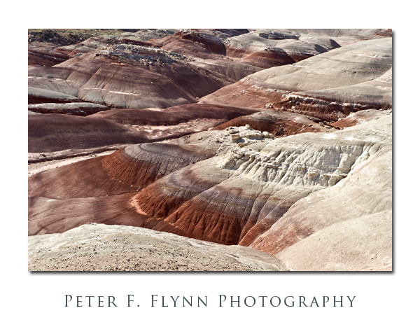
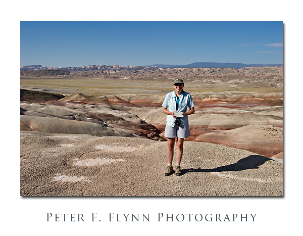
Capitol Reef National Park, UT. Given the vast area, it is simply not possible to photograph the entirety of the Cathedral Valley in favorable light in a single day.  Yes, I know, I said that you don’t always need the light of the golden hour to render compelling images, but there are practical limitations.  I believe that Cathedral Valley can be well-covered in two days, provided that weather and road conditions cooperate.  As I have observed in a previous entry, I believe that the preferred route starts at Caineville, at the opposite end of the ‘standard’ loop, which provides a formula for obtaining images of the lower Cathedral Valley or the western sections of the upper Cathedral Valley.  The significant missing element of this strategy is the opportunity to create morning-light images of the southeastern sector of the Cathedral Valley, and most notably, The Bentonite Hills along the Hartnet Road.

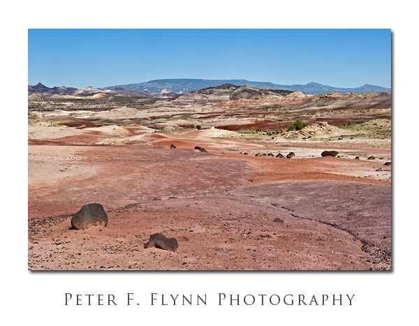
According to the Park geology website, the Bentonite Hills are part of the Brushy Basin shale member of the Morrison Formation, laid down in the Jurassic Period, from 156 to 147 million years ago.  The formation is characterized by low-lying smoothly-contoured hills, with bands of color that may include blues, greens, reds, and violets.  Bentonite is a silicate clay formed from volcanic ash that may include aluminum, calcium, potassium, and/or sodium.  Close up, the surface is rough and broken in what some has characterized as a popcorn-like appearance.  If there was ever an expanse that deserved the name ‘badlands’, The Benonite Hills is it.  Hardly a thing grows anywhere, not even exploratory shoots.

The Hills are most easily reached from the ‘standard’ route around Cathedral Valley, starting from the Fremont River ford.  The Fremont is a modest stream under normal conditions, and is usually easily crossed.  The road winds upward in to The Bentonite Hills, gaining perhaps a few hundred feet in a half-mile, entering the lower Cathedral Valley.  The Hills are about nine mile west of the river crossing, along a gravel road that can be traveled in all but the most inclement conditions.  The road leads pretty much straight though the middle of the formation, so that compelling images can be made looking north/south-eastward (morning) or north/south-westward (late afternoon).

Note that bentonite readily absorbs water (up to many times its own dry weight), and consequently the material becomes impossibly sticky when wet.  Thus, travel through The Bentonite Hills should not be attempted during or shortly after significant rain.

The images above were recorded at around 09:00 MDT on July 25, 2010, using the Nikon D3s and the AF-S NIKKOR 24-70mm f/2.8G ED lens at various focal lengths.  The 24-70mm it is remarkably sharp at all focal lengths.  A major critique is that it lacks VR – but I do not believe that this is a serious shortcoming.  I find this range, 24mm-70m, to be very serviceable in the field.

Copyright 2010 Peter F. Flynn. No usage permitted without prior written consent. All rights reserved.
Glass Mountain

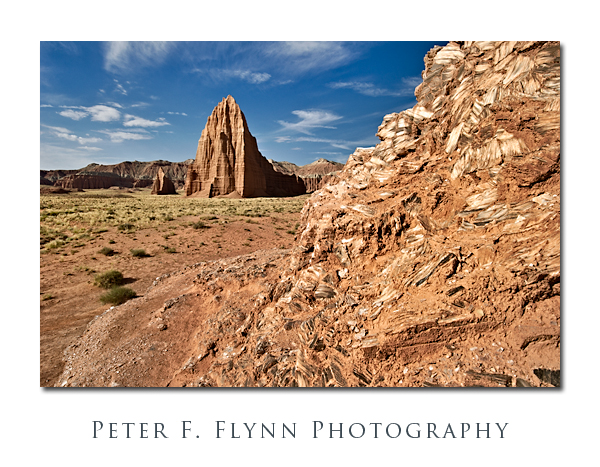
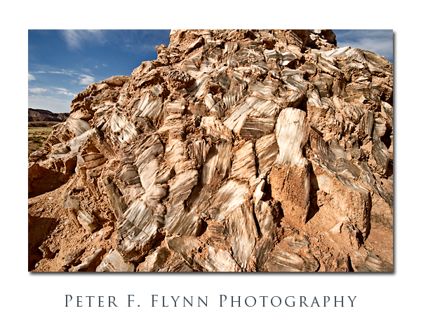
It’s not really made of glass, of course, but if you are traveling in the Cathedral Valley of Capitol Reef National Park, the exposed mound of selenite crystals (gysum) is definitely worth a stop.

Glass Mountain is located about 0.5 miles north of the Temple of the Sun along a road that splits off from the path that leads to the Temples.  The Mountain is a jumble of large crystals that rise about 20 feet from the valley floor.  There is a fair amount of clay covering the crystals, and as shown below, there is likewise a significant amount of inclusions within the milky white crystals themselves.

Images of Glass Mountain were recorded at around 09:15  on July 23, 2010, using the Nikon D3s and  AF-S NIKKOR 16-35mm f/4.0G VR ED at the 20mmk (first image) or 16mm (2nd image).  Exposure was f/16.0 and 1/250s or 1/400s, ISO 400.

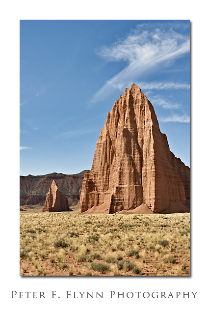
In addition to the obvious setup with Glass Mountain in the foreground and the Temple of the Sun and the Temple of the Moon in the background, this spot is also an excellent location from which to make a medium telephone shot of the Temples alone as shown below.

The image of the Temples of the Sun and Moon was recorded using the AF-S NIKKOR 24-70mm f/2.8G ED lens at 52mm.  Exposure was f/16.0 and 1/80s, ISO 200.

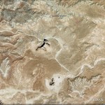
GPS coordinates of the site are 38° 27.2863′ N, 111° 11.5066′ W.  A Google-Earth image of the site is shown below:

Copyright 2010 Peter F. Flynn. No usage permitted without prior written consent. All rights reserved.
Temple of the Sun, Temple of the Moon

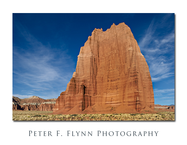
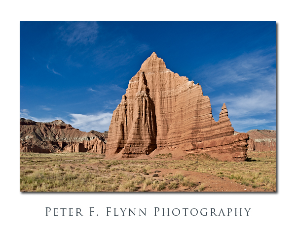
The Temple of the Sun and The Temple of the Moon are found near to one another in the most beautiful and remarkable Cathedral Valley District of Capitol Reef National Park.  The area is most easily reached from the Cainville Wash Road (about 18.5 miles east of the Visitor Center), which may be accessed by traveling east from nearby Torrey, the Park Campground, or points in the vicinity along Highway 24.  Although these natural cathedrals can be reached by traveling the commonly suggested route from the (Fremont) River Ford Crossing, e.g., clockwise around the Loop Road, if you will want to visit them during morning light (as you certainly should), then you must approach from Caineville.

The Temples are the first in a series of remarkable sights that await visitors traveling the anti-clockwise direction on the Cathedral Valley Road (mostly northeasterly).  They are within a quarter mile of one another at approximately 17.5 miles from the entry point at the Caineville Wash.

The images above of the Temple of the Sun and the Temple of the Moon were recorded at around 08:00 on July 23, 2010, using the Nikon D3s and the PC-E NIKKOR 24mm f/3.5D ED.  Both images made shooting almost exactly into the west, since the morning sunlight shines directly onto the rock surfaces – beauty!  Exposure was f/16 and 1/60s (+0.67 EV), ISO at 200.  For rendering images of monoliths like the Temples, there is simply no substitute for the PC-E lens.  The shift controls are efficient and the lens is among the sharpest in the Nikon (or any) inventory.  The lens is manual focus, but the camera will indicate when you are on focus, so it is a minor compromise – negligible actually.  Easily one of my favorite lenses.

The Temples are composed of Entrada Sandstone formed from materials deposited during the Jurassic Period, approx 175 Ma +/- 30 Ma.  This is the same dark red layer that is prominently exposed in Arches National Park, Capitol Reef National Park (obviously, but throughout the park), and also prominently in Goblin Valley State Park.  The complete USGS specification for the deposit is ‘Entrada Sandstone of the San Rafael Group‘ and the type style is located at Entrada Point.  The big question then, is why only a few monoliths survive to tower over the valley floor.  The answer is that local fractures dominate the erosion pattern and that the valley as we see it now is the result of the random faulting and subsequent erosion of the Entrada Sandstone layer over the eons.

GPS coordinates for the site (closer to the Sun) are 38,27.0992N/111,11.4461W.  Read that 38 degrees, 27.0992 minutes north latitude; 111 degrees, 11.4461 minutes west longitude.

A Google Earth image of the area encompassing the Temple of the Sun and the Temple of the Moon appears below:


Copyright 2010 Peter F. Flynn. No usage permitted without prior written consent. All rights reserved.