Posts Tagged ‘HP’

Strike Valley Overlook

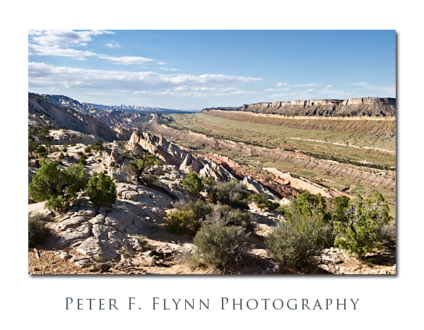
One of the highlights to a visit to Capitol Reef National Park is a drive south along the Notom-Bullfrog Road (NBR).  The NBR heads south-southeast from the junction with Utah Highway 24 (about 9 miles east of the Visitors Center), and slips along the margin between the Waterpocket Fold and Strike Valley.  At about 34 miles from the junction of the NBR and UT24, you reach a junction that heads westward up the Burr Trail Switchbacks.  A short drive west from top of the switchbacks brings you to the Upper Muley Twist Road that heads north along the Waterpocket Fold.  From the end of the road a short hike eastward brings you to a world-class perch, the famous Strike Valley Overlook – seriously, I’ve walked all over the west, this may be THE place.

To be precise, a ‘strike valley’ is a common geological formation found most anywhere immediately adjacent to a significant fold or upheaval.  What we are talking about in this entry however is among the best examples found anywhere.  This strike valley runs along the southern portion of the Fold from Cedar Mesa Camp about 11 miles south of UT 24 to the southern margin of the Park.  The overlook grants views of the Strike Valley north and south along the Waterpocket Fold, and east to the Henry Mountains.

The image above was recorded at 18:00 MDT on July 24, 2010, using the Nikon D3s and the NIKKOR AF-S 24-70mm f/2.8G ED lens at 42mm.  Exposure was f/16 and 1/200s (+0.33EV), ISO 400.  Coordinates of the site are 37,52.9900N/111.2.5372W.

The overlook may also be reached from the west, by traveling east 26 miles out of Boulder, UT.  The Burr Trail Road is paved from Boulder to about 5 miles before the switchbacks.  On this visit we executed a loop trip back along this route to Boulder, and then north to Torrey, UT, along the magic UT Highway 12.

A few important suggestions.  It would be an excellent idea to stop by the Visitors Center and chat with the staff about road conditions.  Be aware that Park Staff are programmed to speak from a ‘better safe than sorry’ perspective, however this truly is a remote region with no water, and challenging driving conditions.  The NBR is paved for the first 5 miles south from the junction with UT24, and then converts into dusty washboard south of that point.  As is true most everywhere in south-central UT, roads in wet to very wet conditions are impassable, as in if you attempt to move you will slide off of the road, or become stuck in thick mud.  The Burr Trail switchbacks are steep, but perfectly safe in dry conditions – they might be a bit of  thrill for those with little backcountry driving experience.  The Upper Muley Twist Road cannot be safely navigated by a low-clearance vehicles, although 4WD is probably only necessary in wet conditions.  I also predict that very large pickups and wide vehicles (think Hummers) will have to execute some tricky moves to make it to road’s end (we drove a Toyota Tacoma with the crew-cab and associated short-bed).

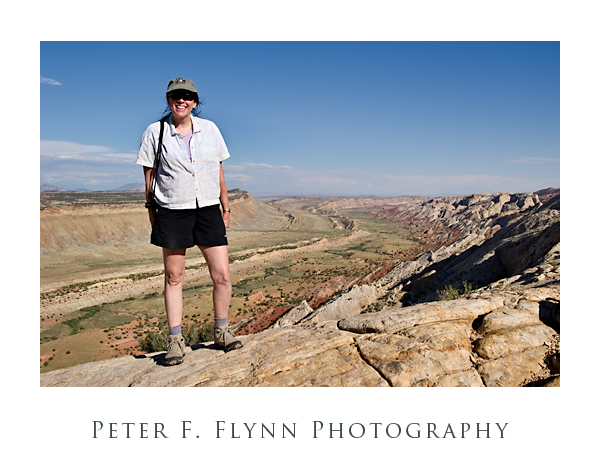
Finally (below), a shot of The HP, and the southern view into the Strike Valley.  The image was recorded using the D3s and the 24-70mm lens at 32mm.  Exposure was f/16 and 1/400s, ISO at 400.  Handheld.  You could not deduce it from her calm and relaxed appearance in the image, but the HP was the most awesome support ever – carrying a 20lb camera bag and tripod while chasing a panicky photog back and forth along a 200 meter section of the Fold in the failing light.

Copyright 2010 Peter F. Flynn. No usage permitted without prior written consent. All rights reserved.
Coyote Crops

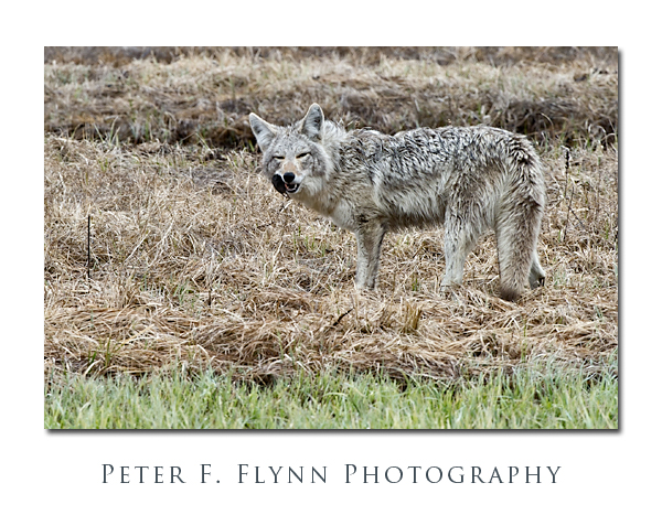
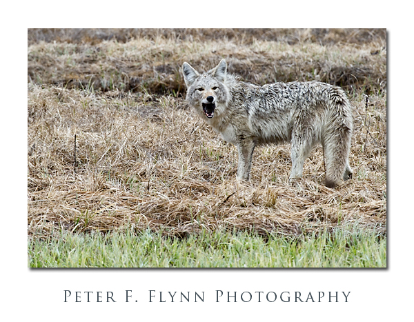
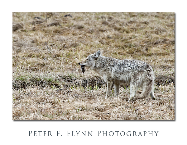
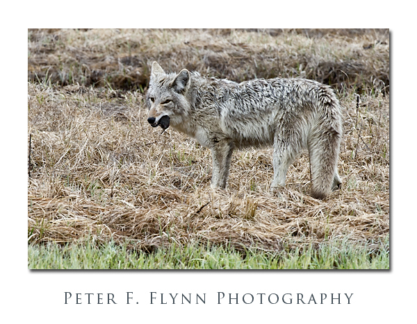
Blame it on the HP.  ‘The pictures on your blog are too small’, says the HP.  This in reference to the May 20, 2010 entry.  I respond that they are the standard size (which is about 520px by 347 px, in a frame template).  ‘But, you can’t see what the coyote is eating’, adds the HP.  I explain that I don’t usually publish cropped images, since it’s kind of poor form (a mild understatement in some quarters).  The look.  The look that says, ‘What, another silly rule from your geek-photographer cronies?’  Cronies?  I don’t even have any cronies…  Hmm.

So I sort of forget about the discussion.  Not for long though.  Two days later the HP says, ‘So, did you make up some close-ups of the coyote?’ Not yet sweets.  ‘You should do that so people can see what the coyote is eating’, the HP responds.  There are choices.  I make the correct one.  The results are shown above and below.

So what does the HP think of the cropped images?  ‘Ewww! Cool!’  Yep, blame it all on the HP.

The cropped images of the coyote and some partially consumed rodents were recorded at around noon on May 20, 2010, in the Hayden Valley of Yellowstone National Park using the Nikon D3s and the AF-S NIKKOR 200-400mm f/4G ED VR lens at 400mm.  Exposures were all at f/8 with a shutter speed of around 1/2000s, ISO at 1600.  All shots were made handheld.  I’m not aware of any lens that is better suited to general wildlife photography than the 200-400mm VR.  It is not light by any means (~7 lbs), nor is it the sharpest lens at long distance, but the ability to shoot handheld is indispensable.

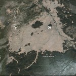
The official map of Yellowstone National Park may be found here.

A Google Earth image of the Hayden Valley appears below:

Copyright 2010 Peter F. Flynn. No usage permitted without prior written consent. All rights reserved.
Yellowstone Diary: May 17, 2010

The third day of our trip to Yellowstone National Park started with a visit to the West Thumb of Yellowstone Lake.  This area includes West Thumb Geyser Basin, Grant Village, and of course the eponymous extent of Yellowstone Lake.  Although smaller in total area than either the Upper Geyser Basin or the Midway Geyser Basin, West Thumb Geyser Basin boasts a number of excellent thermal features including Abyss Pool and Black Pool on the northern edge of the central basin; Fishing Cone on the Yellow Lake side of the central basin; Seismograph and Bluebell Pools on the southern edge of the basin; and the springs along the center line of the basin including Surging Spring, Percolating Spring, Ephedra Spring and Blue Funnel Spring.  All of these features may be easily visited over short distances along two concentric boardwalk loops.

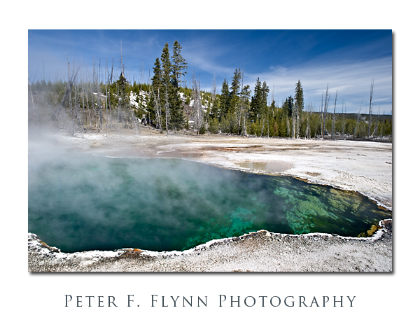
The image above of Abyss Pool, was recorded at 10:00 MDT on May 17, 2010, using the Nikon D3s and the AF-S NIKKOR 24-70mm f/2.8G ED lens at 24mm.  Exposure was f/16 and 1/30s (+1 EV), ISO 200.  Polarizer used to cut the reflection from the hot spring.  Abyss Pool is a very deep and remarkably beautiful spring, unique even amongst superlative thermal features.

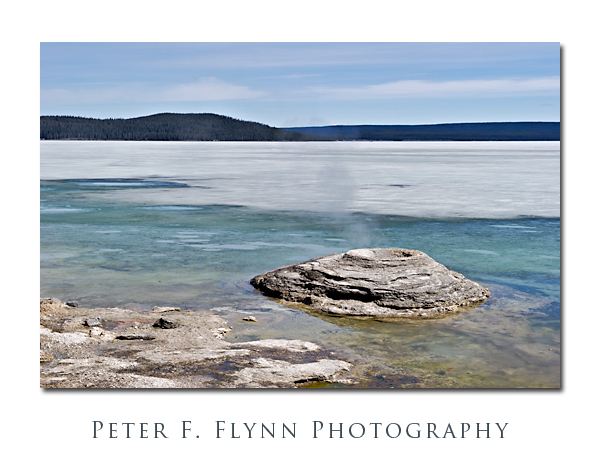
The image above of Fishing Cone Geyser was recorded at 10:26 MDT using the D3s and the 24-70mm standard zoom at  60mm.  Exposure was f/16 and 1/50s (+0.67 EV), ISO 200.  Polarizer.  The origins of the name of this famous thermal feature derive from tales told by mountain men who boasted of a lake in which one could catch a fish, and then immediately dunk it into hot spring, cooking it right on the hook.   As you can plainly see in the image above, Yellowstone Lake was still capped with several inches of slushy ice, and there was only about 20-50 feet of water between shore and the ice.  In spite of the shortage of clear water, what was available was enough to entice otters out for a swim.

In high season the West Thumb area is extremely popular, however this early in the year you will find only minimal services, e.g.,  just gasoline and a small convenience store.

After visiting the West Thumb area, we backtracked northwest along the highway to visit the Midway and Lower Geyser Basin areas.  Although these areas have fewer geysers, the ones that are found here are relatively active.  The springs are the best in the park, and include the singly most beautiful thermal feature found anywhere on the planet, the Grand Prismatic Spring.  Finally, the paint pots found here round out the roster of amazing thermal attributes that exist in this part of the caldera (I’ll try to patch in pics of both the spring and mud pots in future entries)

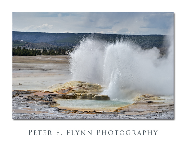
The image above of Spasm Geyser was recorded at 15:35 MDT using the Nikon D3s and the (new) AF-S NIKKOR 70-200mm f/2.8G ED VR II at 120mm.  Exposure was f/13 and 1/1600s (+0.67 EV), ISO 1600. Polarizer.

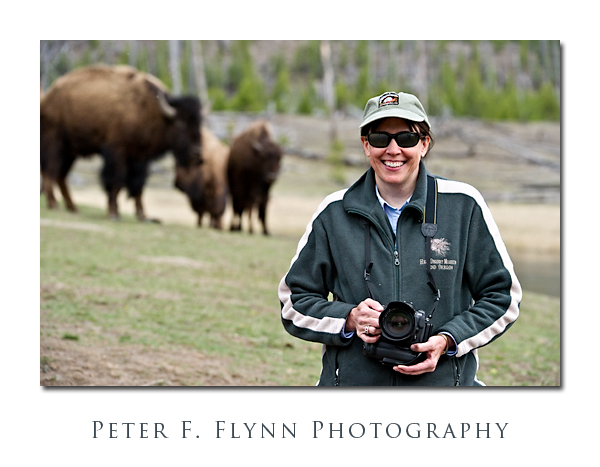
We spent the late afternoon along the Madison River, where we were most privileged to observe bison crossing the Madison River in search of the very finest YNP graze.  The image below of the HP confirms that she’s enjoying the awesome opportunity to photograph these grand animals in their natural environment.  Note that the HP is sporting the D300 – shot a bunch of excellent images  too- stay tuned for a guest entry.

Not only do the adult animals wander back and forth across the river at will, but calves also make the excursion.  The crossing of a calf is attended by no fewer than 3-4 cows, who first nose the calf into the water, and then wade across the river on the downstream side, harboring the calf and preventing it from descending too rapidly in the current.  I was completely unprepared for the sophistication with which the bison herds carry out their daily business.  The composite image shown below was recorded at about 18:15 MDT using the D3s and the AF-S VR Zoom- NIKKOR 200-400mm f/4G IF-ED at 400mm.  Exposures were in the neighborhood of f/11 and 1/640s, ISO 3200.  No noise reduction employed in these images.

Copyright 2010 Peter F. Flynn. No usage permitted without prior written consent. All rights reserved.