Posts Tagged ‘CARE’

Winter in the Waterpocket Fold: East Side

Capitol Domes from the Notom Road

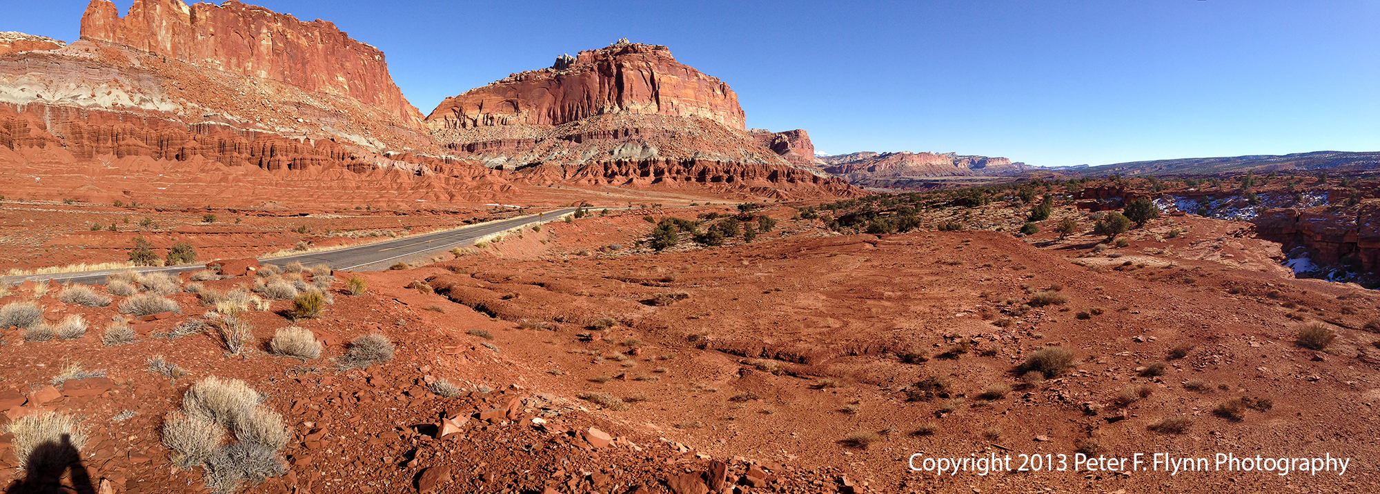
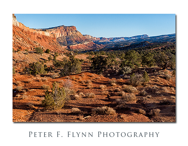
Remarkably, many visitors to Capitol Reef never get a good view of the sandstone domes from which the park derives its name.  In fact it is quite easy to see this defining feature, which requires only a few minutes drive east of Fruita and down the famous Notom Road.  The perspective from Notom Road is completely different from that found in the north or western sides and well-worth the adventure.

The image above, of the famous Capitol Domes, was recorded on February 16, 2013, at 9;30 MST, using the Nikon D800E and the 70-200mm f/2.8G IF-ED VRII lens at 105mm.  Exposure was f/8.0 and 1/100s, +0.33 EV corrected in processed.

Wild Turkeys Along the Notom Road

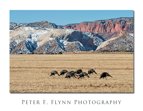
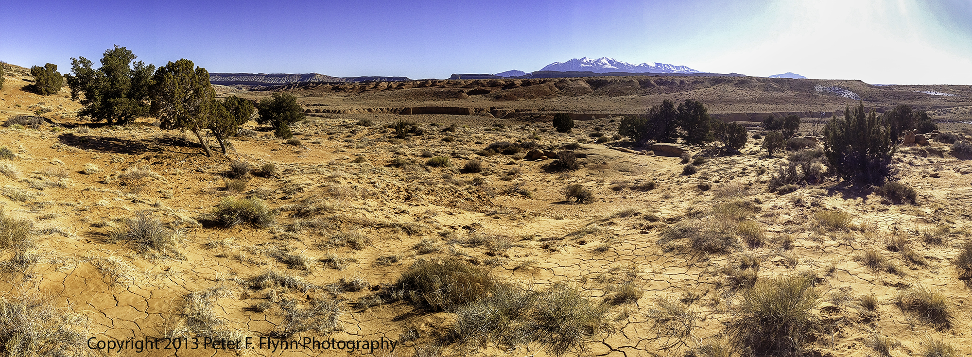
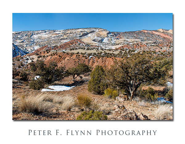
Capitol Reef is a relatively recent park (1971), that was developed rather slowly, starting out as a monument (1937), and slowly converted to NP status.  A major reason for the slow development of the park was the existence of small private land holdings within key sectors.  Even long after the park boundaries were established, private holdings continue to define travel around the park.  There are a number of private holdings that lie between the Notom Road the park boundary – especially in the northern section of the Notom Road, just south of SR24.  Here there are several medium-sized farms.  In one of these we found the small band of wild turkeys shown above.  Image recorded at 11:30 MST using the D800E and the 70-200mm at 200mm.  Exposure was f/11 at 1/500s, ISO 400, +0.33EV corrected during the raw conversion.

PFF_D800E_20130216_0178_Framed

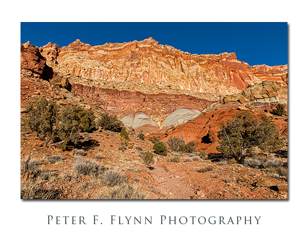
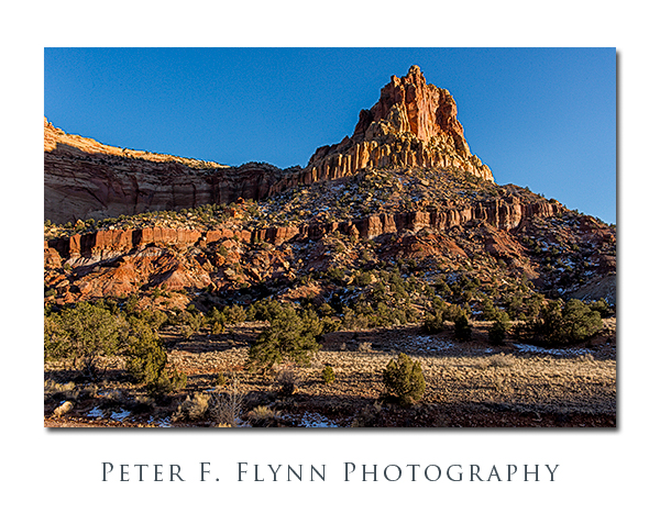
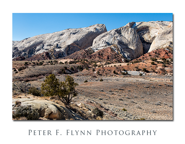
The red-rock toothy edge of the reef makes a beautiful contrast against the blond Navajo Sandstone above.  The reef faces towards the east towards Strike Valley, and the Notom Road lies in between.  This shot, made facing west towards the reef, was recorded at noon using the D800E and the AF-S NIKKOR 24-70mm f/2.8G ED at 24mm.  Exposure was f/16 and 1/320, ISO 800, +0.33EV corrected – no idea why I dialed that combination, should have been f/11, with ISO at 400, or maybe f/8, 1/640s and ISO at 400…

Bentonite Formation Along the Notom Road

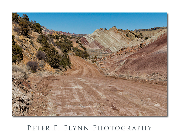
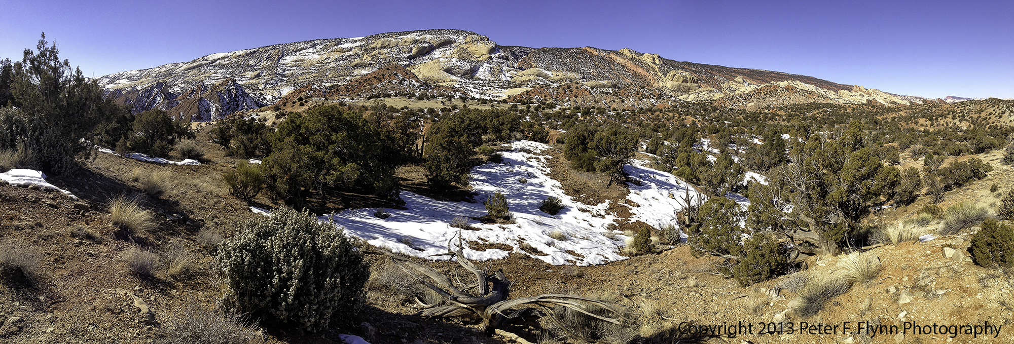
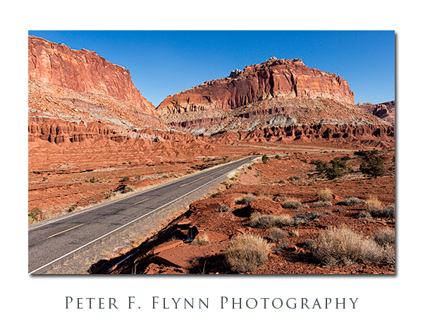
The shot above shows the condition of the road is winter – not too bad here, although there were sections became inundated with snow-melt around mid-day thus became pretty damned slippery.  Travel on this side of the park is generally easy-going, but one should be prepared for all the mischief associated with off-highway driving.  The colorful striated formation is the background is bentonite, which is visible in several areas on the east of of the park.  Image recorded at 12:30 MST using the D800E with the 24-70mm lens at 62mm.  Exposure was f/11 and 1/800s (+0.33 EV), ISO 400.

Winter in the Waterpocket Fold

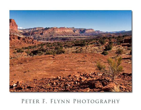
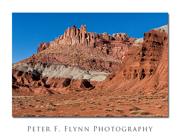
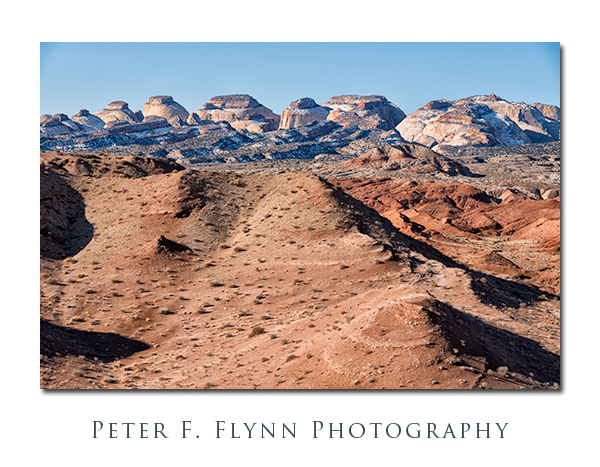
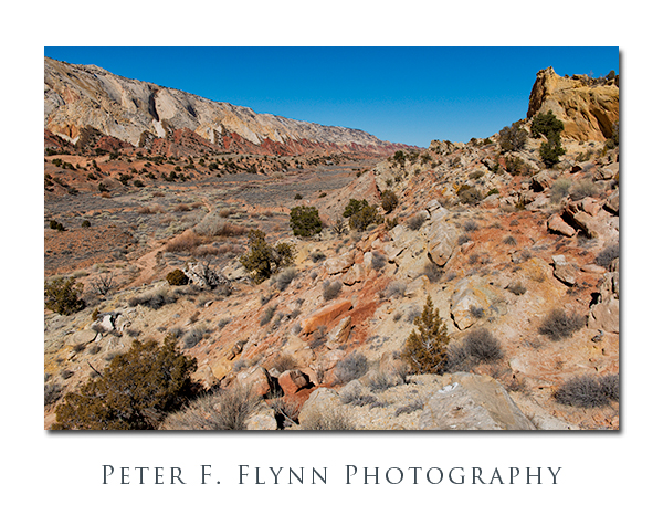
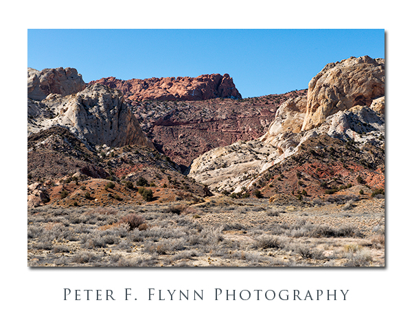
The Notom Road closes in on the reef as you travel south.  To gain the best views of the reef it is often  necessary to make a short hike over a low-lying ridge that runs parallel to the road.  The images above and below were shot from the same location looking south and north respectively.  Shots made at around 12:30 MST using the D800E and the 24-70mm lens at 34mm and 48mm respectively.  Both exposures were made at f/11, with shutter speeds of 1/400s and 1/1000s respectively (+0.33 EV), and ISO values of 400 and 800 respectively.  This is one of our favorite spots anywhere.

Winter in the Waterpocket Fold

Finally, a good turn-around spot for visits to the east side of the fold is the junction with the Burr Trail.  Here you can choose to continue along the Notom Road to the Bullfrog Marina (Lake Powell), or head west up the Burr Trail Road towards Boulder.  The latter choice makes for an excellent loop trip back to Torrey and the park campground.  The image below of the switchbacks at the beginning of the Burr Trail Road was recorded at around 12:45 MST using the D800E and the 24-70mm lens at 70mm.  Exposure was f/11 and 1/800s (+0.33 EV), ISO 800.

Winter in the Waterpocket Fold

Copyright 2013 Peter F. Flynn.  No usage permitted without prior written consent. All rights reserved.

Considering iP5 Panos

Yeah, I’m pretty skeptical.  And, I suppose that I am somewhat notorious for providing rather blunt opinions.  Sometimes I even imagine that people ask me about things that they know that I’ll respond to with a firm, ‘Well, that’s bullshit’, just to hear my signature phrase.

I’ve never been a huge fan of Apple technology – the substance over hype ratio is too close to zero.  The history of the company is too steeped in toy-making for me to have taken them seriously.  Until recently that is.  No one can deny the usefulness of the integrated approach that is shared by the Macbook, iPad, and iPhone, my skeptical self included.  I have had the laptop and iPad for some time now, and a few months back, switched from my Android phone to the generation-5 version of the iPhone, aka, iP5.  As anticipated, the iP5 is an excellent extension of Apple-tech.

Eventually, I stumbled onto the Camera app, and a bit later the rather curious implementation of pano capture.

Could the iP5 actually do something photographically useful?  ‘Bullshit’, I’m thinking, but let’s just verify.  After mucking about for a while, I started to make some progress, a recent result of which is shown below – note that you must click on the thumbnail to view the larger image.

Capitol Reef from Utah State Route 24

I dunno, maybe it’s not too bad after all – certainly not just BS anyway.  The image above was recorded at about 14:40 MST on February 15, 2013.  The location is just west of the Capitol Reef NP Visitors Center along Utah State Route 24 (SR24).

Capitol Reef from the Notom Road

The image above was recorded along the Notom Road, just outside Capitol Reef NP, at about 10:14 MST on February 16, 2013.  The pano was shot looking east, and therefore includes the morning sun.  I am positively impressed by the dynamic range of the iP5 camera.

Here’s one final image for this entry, shot looking west from the Notom Road towards Capitol Reef on February 16, 2013 at around 11:00 MST.  I include this shot to remind you that all of the normal pano-oriented considerations apply (of course), including issues regarding dynamic range, and especially for this image, distortions associated with (not) rotating around the nodal point.  Yeah, what does a nodal point for the iP5 mean?

Capitol Reef from the Notom Road

I’ll write more about shooting iP5 panos, including recommendations for hardware and software, and illustrate same with more reference images in future entries.  Stay tuned!

Copyright 2013 Peter F. Flynn.  No usage permitted without prior written consent. All rights reserved.


Winter in the Waterpocket Fold: West Side

Winter in Capitol Reef

Winter is one of our favorite times to visit the Capitol Reef area.  Crowds are never at the level that you find at the more popular Utah parks – Arches, or heaven-forfend, Zion in high-season – but in winter you practically have the park to yourself.  The area only receives about 10 inches of annual precipitation, and much of that falls during the late-summer monsoon season, and thus the weather is generally favorable for travel throughout the park.  We have never ventured into the Cathedral Valley area in winter, but our guess is that travel in this section could be quite challenging due to lingering snowfall – as always, it is advisable to consult with the park rangers.  Note:  although some of the hotels are open for business year-round, there is virtually no food service in Torrey until the middle of March.

The images above and below were recorded along UT24 just west of the Visitors Center at around 15:00 MST on February 15, using the Nikon D4 and the AF-S NIKKOR 24-70mm f/2.8 ED lens (55mm and 38mm respectively).  Exposures were f/16 and 1/640s (above), and f/16 and 1/500s (below), ISO at 800 (both).  Handheld.

Winter in Capitol Reef

Capitol Reef encompasses at least four distinct environments:  The west side, which is easily accessed along the well-paved Scenic Drive (yeah, it’s literally named that); Fruita and Fremont Canyon along Highway 24; the northern section, which includes Cathedral Valley and the South Desert, accessed by Cathedral Valley Road and the Hartnett Road; and the east side, accessed by the Notom-Bullfrog Road.  In this entry we’ll review some images recorded along Scenic Drive.

Winter in Capitol Reef

Scenic Drive begins about 1.6 miles south of the Visitors Center, just past the park campground at the Fee Station($5 to run the drive).  The route tracks south-southwest for about 6.5 miles, providing excellent views of the rugged west side of the Waterpocket Fold.

Winter in Capitol Reef

The stratigraphy of the west side of the Fold consists of layer of shale and sandstone, leading to striking contrast moving from Moenkopi shale to Chinle Formation to Wingate, Kayenta, and Navajo Sandstone layers.


Winter in Capitol Reef

The images above and below were recorded on February 15 at about 17:00 MST using the D4 and the 24-70mm lens at f/11 with shutter speeds at ~1/500s, ISO 1250.  All shots made handheld.

Winter in Capitol Reef

Winter in Capitol Reef

The image-link of Capitol Reef stratigraphy is used by permission of the United State Geological Survey.  An excellent map of Capitol Reef geology may be found here.

Copyright 2013 Peter F. Flynn.  No usage permitted without prior written consent. All rights reserved.