Posts Tagged ‘Photomatix’

Cisco, UT 84515

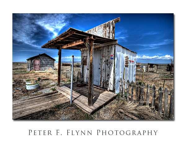
Cisco, Utah, was born during the late 19th century era of the steam engine, and became an important watering stop for the locomotives.  The railroad station became a key shipping center for the livestock that were managed in the open range country of the Book Cliffs.  Unfortunately, the diesel locomotive made stops at Cisco unnecessary, and by the 1950’s the long decline of the town had began.  Unlike Greenriver, which lies adjacent to I70, and which is an important stop for travelers, Cisco was left too far off of the freeway to gain significant commercial traffic.  Hard luck.

The image above, of the old Cisco post office, was recorded on April 18, 2010 at about 12:40 MDT, using the Nikon D3s and the (new) AF-S NIKKOR 16-35mm f/4G ED VR lens at 16mm.  Exposure was f/16 and 1/160s, ISO 400.  One RAW images was converted to HDR using Photomatix 3.1 ( see below for for processing details).

Regional guides list Cisco as a ghost town.  I’m not so sure, since while it certainly does have certain attributes of a ghost town, it has also been exploited as a junk yard – plenty of character to be sure, but for ghost town aficionados it’s most probably not the real deal.  Regardless of how you define it,  the place certainly is a great location at which to refine your High Dynamic Range photography (HDR) skills.   Light, dark, decrepit structures, old, abandoned cars, it’s all in there.  The circumstance lends itself most naturally to what I will name – without any judgment – fantasy HDR.  For you HDR aficionados, by ‘fantasy’, I mean to conjure up the effect one gets with (in Photomatix language) Detail Enhancer mode tone mapping conversion.  Of course we’ve all seen this effect, and there is tons of this stuff on the web – some of it is very nice.  I include links to a few of the more active HDR sites that describe Detail Enhancer mode strategies below:

http://www.aguntherphotography.com/tutorials/raw-hdr-processing.html

http://www.stuckincustoms.com/

http://www.vanilladays.com/gallery/tag/hdr/

http://www.robertcorrell.com/

The full Detail Enhancer mode specifications for this file are shown below:

Photomatix Version 3.1
Method: Details Enhancer
Luminosity: 5
Strength: 100
ColorSaturation: 88
WhiteClip: 5.0
BlackClip: 5.0
Smoothing: High
Microcontrast: 10
Microsmoothing: 2
Gamma: 1.0
HighlightsSmoothing: 0
ShadowsSmoothing: 0
ShadowsClipping: 0
ColorTemperature: 0
SaturationHighlights: 0
SaturationShadows: 0

Copyright 2010 Peter F. Flynn. No usage permitted without prior written consent. All rights reserved.
A Rainbow Turned to Stone

A visit to Rainbow Bridge National Monument is one of those trips that proves the adage about the  journey being as important as the goal.  To be sure, it does take a bit of commitment to get to the Bridge, e.g., a five-hour, 50 mile, boat trip over Lake Powell, but it is a day that will fill your skull with most excellent memories.

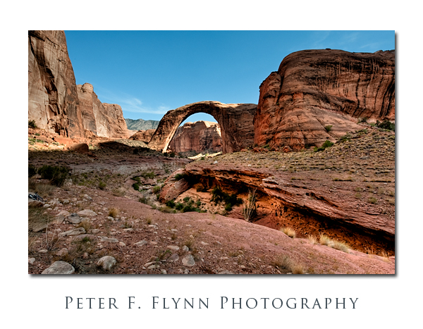
The bridge is 294 feet high, measured from the base to the top of the span, and 275 feet wide.  The top of the span is 45 feet thick and 33 feet wide.  One of world’s largest natural spans is thus curiously massive.  Recall that bridges are distinct from arches in that bridges are formed by the action of flowing water, in this case carving out Navajo Sandstone.  The bed of the ancient river that formed the bridge is still very apparent, but in recent history the only significant water that you might find in it comes from the (sometimes) rising waters of Lake Powell.

The composite, highly processed, HDR image above was recorded at approximately 16:45 MST on August 28, 2009, using the Nikon D700 and the AF-S NIKKOR 14-24mm f/2.8G ED lens at 19mm (FX).  Exposure was f/16, and shutter speeds to cover 4 EV.  Two source images were generated using Photomatix Pro 3.2.7: one was created using the Tone Mapping method, and the other generated using on Detail Enhancer method.  The two images were blended together using Photoshop CS4.  My goal was to generate a final image that captured the sense of magic about the place, and for this reason I allowed the fanciful, illustrative feel of the Detail Enhanced HDR image to show through a bit.  GPS coordinates at the position where the images were recorded were 37,4.7403N, 110,59.9628W.  GPS positions in this entry were all made using the Nikon GP1, which pretty much lives on the D700.

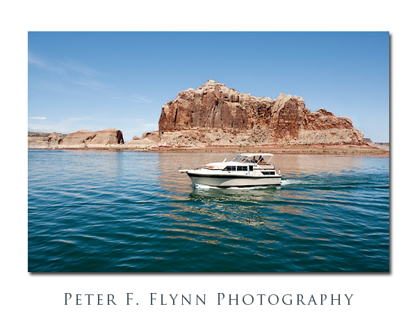
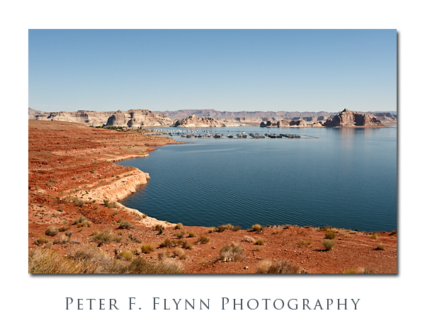
The image above, of Wahweap Marina at Lake Powell, was recorded at 10:43 MST, using the Nikon D700 and the AF-S NIKKOR 24-70mm lens at 44mm.  Exposure was f/16 at 1/125s, ISO 200.  Coordinates were 36,58.485N, 111,29.3835W.

We began our trip to Rainbow Bridge out of Wahweap Marina aboard the Desert Shadow.  There are both all-day and half-day cruises to the Bridge, and we opted for the half-day afternoon adventure that left at 12:30 and returned at ~18:00 (MST).  It’s not inexpensive at over $120 per person, but it is a good value.  You can also hike to the Bridge, but it is a long trip (+10 miles), and you are required to obtain a permit from the Navajo Nation.

The image above was recorded at 13:40 MST, using the Nikon D700 and the AF-S NIKKOR 24-70mm f/2.8G ED lens at 24mm.  Exposure was f/16 and 1/250s, ISO 400.  Coordinates were 37,0.4536N, 111,27.4542W.

The boat trip itself is terrific.  The weather is reliably beautifully warm and dry, and the speed of the boat generates a lovely breeze on board.  The rock formations along the former course of the Colorado River are stunning, and constantly changing.  I could recommend the cruise alone.

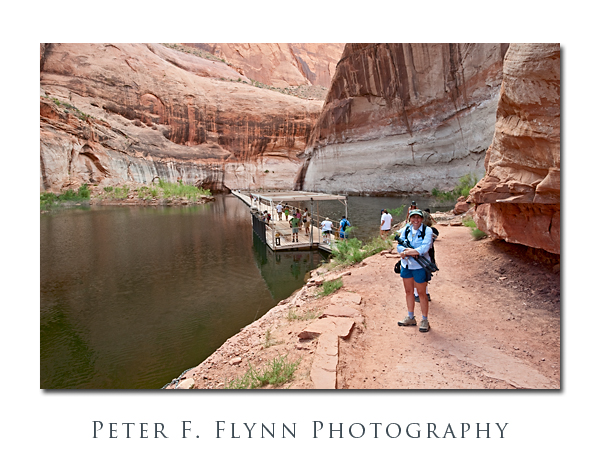
At buoy 49 the boat ducks into the narrow and winding Forbidding Canyon, that leads in about 2 miles to a large floating courtesy dock that is maintained by the NPS.  The dock connects to dry land about 2 miles from the Bridge.

The image above of the HP about to traverse between the Rainbow Bridge trail and the boat dock, was recorded at 17:00 MST, using the Nikon D700 and the AF-S 14-24mm f2.8G ED lens at 22mm.  Exposure was f/16 at 1/50s, ISO 800.  Coordinates were 37,4.7644N, 110,58.0831W.

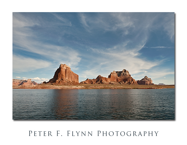
The image above, of Dominguez Butte and the Crossing of the Fathers, was recorded on August 28, 2009, at 18:20 MST, using the Nikon D700 and the AF-S NIKKOR 24-70mm f/2.8G ED at 24mm.  Exposure was f/11 at 1/500 and ISO 400.  Coordinates were 37,2.3442N, 111,17.2227W.  This image was recorded late in the afternoon on the return trip to Wahweap Marina – beautiful light.  It would be nearly impossible to tell at the scale at which the image is rendered, but the moon lies just a bit above dead-center.

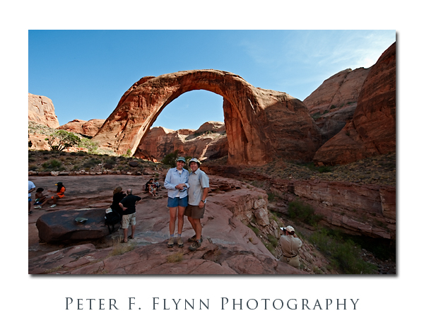
And finally, here’s an image of the HP and the Dude, near a rainbow turned to stone.

An NASA image of Rainbow Bridge National Monument taken by the Iknonos satellite appears below:

Copyright 2010 Peter F. Flynn. No usage permitted without prior written consent. All rights reserved.
All Along the Transept

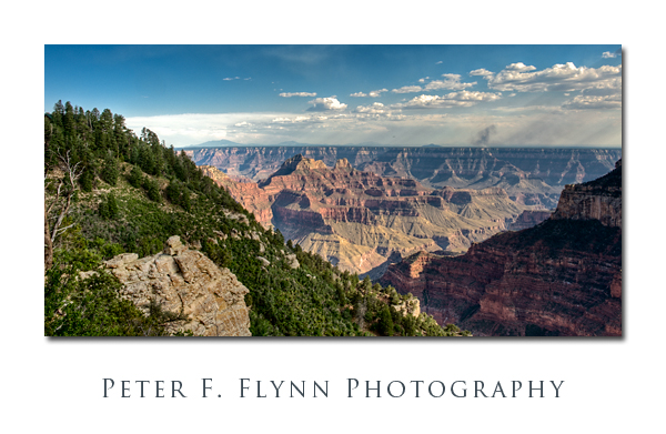
The Transept Trail runs westward from the North Rim Lodge into Transept Canyon – all at the north rim of the Grand Canyon.  So, what’s a transept?  Right, properly-speaking it’s the part of classical cruciform Christian church architecture that crosses between the nave and sanctuary, but in this case the term must be used in a generical form to indicate a minor corridor that crosses or emanates from a more significant space.  Anyway, it’s a lovely walk in the trees, with strategical view points dotting the path.  Note the smoke from a fire on the south rim – look along the horizon about 1/3 from the right edge.  Near sunset, the shadows creep into Transept Canyon well before the sun actually dives below the horizon – a perfect test of HDR techniques.

View from the Transept Trail

The image above was recorded on July 17 at about 18:00 MST, using the Nikon D700 and the AF-S NIKKOR 24-70mm f/2.8G ED at 31mm.  The seven images used to generate the HDR image were recorded f/16 at 1/80s (0 EV), 1/640s (-3 EV), 1/320s (-2 EV), 1/160s (-1 EV), 1/40s (+1 EV), 1/20s (+2 EV), and 1/10s (+3 EV).  The HDR image was generated using Photomatix Pro 3.1, with tone mapping conducted using the detail enhancer mode with the following settings:

Luminosity: 0

Strength 95

ColorSaturation: 46

WhiteClip: 0.249450

BlackClip: 0.000000

Smoothing: Very High

Microcontrast: 6

Microsmoothing: 2

Gamma: 1.000000

HighlightsSmoothing: 0

ShadowsSmoothing: 0

ShadowsClipping: 0

ColorTemperature: 0

SaturationHighlights: 0

SaturationShadows: 0

Additional processing was conducted using ACR 5.4 to adjust Recovery, Blacks, Clarity and Vibrance – and eliminate a few dust spots; and Photoshop to increase contrast and to enhance detail in the clouds using the ‘Overlay move’.

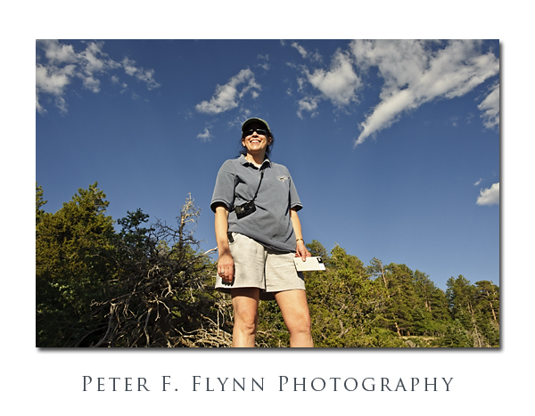
Oh, I nearly forgot.  Below, I include a shot of the HP enjoying the view over Transept Canyon:

The HP at Transept Canyon

This is the first use of the Nikon GP1 GPS encoder:  The coordinates of the site were recorded as follows:

Latitude: 36,12.1678N

Longitude: 112,3.561W

Altitude: 2493.00 m (8179 ft)

Time Stamp: 7/18/2009, 12:45 AM

Click on the thumbnail below for a Google Earth view of the location:

Transept Trail Google Earth Image

The GP1 works very well – if you start it up before you begin composing and checking exposure, etc., it locates satellites just about the time the first exposure is recorded.