Posts Tagged ‘Utah’

Cisco, UT 84515

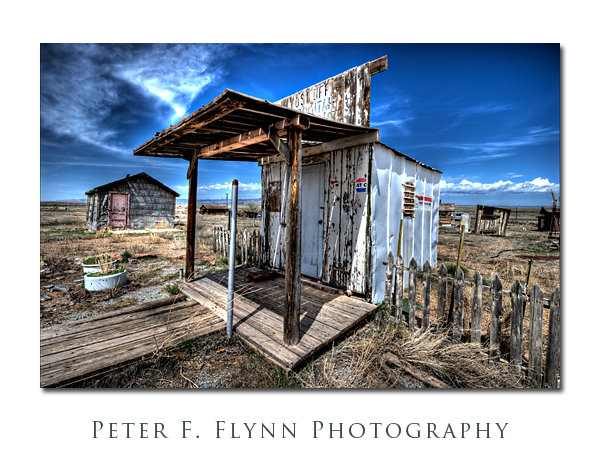
Cisco, Utah, was born during the late 19th century era of the steam engine, and became an important watering stop for the locomotives.  The railroad station became a key shipping center for the livestock that were managed in the open range country of the Book Cliffs.  Unfortunately, the diesel locomotive made stops at Cisco unnecessary, and by the 1950’s the long decline of the town had began.  Unlike Greenriver, which lies adjacent to I70, and which is an important stop for travelers, Cisco was left too far off of the freeway to gain significant commercial traffic.  Hard luck.

The image above, of the old Cisco post office, was recorded on April 18, 2010 at about 12:40 MDT, using the Nikon D3s and the (new) AF-S NIKKOR 16-35mm f/4G ED VR lens at 16mm.  Exposure was f/16 and 1/160s, ISO 400.  One RAW images was converted to HDR using Photomatix 3.1 ( see below for for processing details).

Regional guides list Cisco as a ghost town.  I’m not so sure, since while it certainly does have certain attributes of a ghost town, it has also been exploited as a junk yard – plenty of character to be sure, but for ghost town aficionados it’s most probably not the real deal.  Regardless of how you define it,  the place certainly is a great location at which to refine your High Dynamic Range photography (HDR) skills.   Light, dark, decrepit structures, old, abandoned cars, it’s all in there.  The circumstance lends itself most naturally to what I will name – without any judgment – fantasy HDR.  For you HDR aficionados, by ‘fantasy’, I mean to conjure up the effect one gets with (in Photomatix language) Detail Enhancer mode tone mapping conversion.  Of course we’ve all seen this effect, and there is tons of this stuff on the web – some of it is very nice.  I include links to a few of the more active HDR sites that describe Detail Enhancer mode strategies below:

http://www.aguntherphotography.com/tutorials/raw-hdr-processing.html

http://www.stuckincustoms.com/

http://www.vanilladays.com/gallery/tag/hdr/

http://www.robertcorrell.com/

The full Detail Enhancer mode specifications for this file are shown below:

Photomatix Version 3.1
Method: Details Enhancer
Luminosity: 5
Strength: 100
ColorSaturation: 88
WhiteClip: 5.0
BlackClip: 5.0
Smoothing: High
Microcontrast: 10
Microsmoothing: 2
Gamma: 1.0
HighlightsSmoothing: 0
ShadowsSmoothing: 0
ShadowsClipping: 0
ColorTemperature: 0
SaturationHighlights: 0
SaturationShadows: 0

Copyright 2010 Peter F. Flynn. No usage permitted without prior written consent. All rights reserved.
Courthouse Wash Pictographs

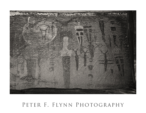
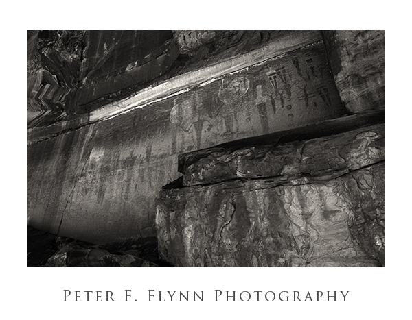
There are a number of excellent rock art panels in the area around Moab, UT.  Perhaps the most accessible of these is the panel that may be found by wandering up the slope at the southern end of the Courthouse Wash Trail that leads out of Arches NP.  This area is just north of US191 at the northern edge of town, about 0.5 mile west-northwest of the bridge that crosses the Colorado River.   The panel was vandalized in 1980 and stabilized but not restored.  A Bureau of Land Management website briefly describes the location and recent history of the site.

Courthouse Wash Pictograph Panel

Courthouse Wash Pictograph Panel

The art is typical of the Barrier Canyon archetype, with large armless trapezoidal anthropomorphs attended by smaller familiars.  The style type may be found within the Horseshoe Canyon Unit of Canyonlands NP.   Horseshoe Canyon was formerly known as Barrier Canyon, and this original name is the source of the title of this important rock art style.  The most famous example is the Great Gallery panel, however other excellent examples exist in Barrier Canyon and in other locations centered around the confluence of the Green and Colorado rivers (Sego Canyon, Head of Sinbad, Moab, etc.).  The style has been attributed with what archeologists have named the Late Archaic period (2000-500 BC), and the artists were believed to be members of  a nomadic hunter-gatherer culture.  What appears to be quite a lot of noise in the images is actually real texture on the rock surface resulting from the efforts of the vandals to scrub the art from the rock surface with wire brushes.

These images are from the archives, and were recorded at approximately 20:00 on June 23, 2006, using the Nikon D70s.  The upper image was recorded using the AF-S DX NIKKOR 12-14mm f/4G IF-ED at 16mm with an exposure of f/18 at 1/40s, ISO 200.  The lower image was recorded using the AF-S DX NIKKOR 18-70mm f/3.5-4.5G IF-ED at 70mm with an exposure of  f/18 at 1/30s, ISO 200.  Yeah, those f-stops are well past the diffraction limit for both lenses – you don’t become an image wiz just overnight, apparently.  Images were processed to maximize contrast.

Owachomo Natural Bridge

Owachomo Bridge

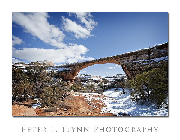
Owachomo Bridge is the southern most of the major bridges in Natural Bridges National Monument.  Owachomo is the Hopi word for ‘rock mound’, and the bridge takes its name from the sandstone feature that lies along the top strata near the center left.

The image above was recorded on 2/14/2009 at 14:30 MST (UTC-7)with the Nikon D700 and the AF-S NIKKOR 14-24mm f/2.8G ED at 14mm.  Exposure was f/16 at 1/160s with an ISO of 200.  White balance was set at Daylight, but was subsequently corrected to a color temperature of 5000 and tint of -6.   The final image is a crop of the original 14mm, and  I would most probably reduce the height by another 10-20% for a final print version.

Of the three bridges in the Monument, Owachomo was the only one we could visit directly on this trip.  The path underneath the bridge was nearly free of snow and ice.  Incidentally, it would be possible to access Kachina and Sipapu Bridges by following the Loop Trail from here even when snow and ice block the more direct routes down to those bridges.  The distance along the Loop Trail from Owachomo Bridge to Sipapu Bridge and back is approximately 8.6 miles.  For more information on Sipapu and other natural bridges and arches, check out the web pages of the The Natural Arch and Bridge Society and UtahArches.com.