Early summer may be our favorite time to visit Grand Teton National Park. There will be snow high on the Tetons through the end of June, which makes for an excellent contrast element to the complex rock formations. The weather is fairly reliable, although as a few of these images will confirm, there is a enough instability to generate some interesting cloud formations. Finally, we tend to spend most of the spring in the YNP, and have to delay a visit to GRTE (pronounced Gertie…) until early June.
Our favorite place to stay is at Jackson Lake Lodge. It is a bit quieter here than at Colter Bay, certainly much quieter than at the Moose Junction area. The lodge proper houses the registration office, gift shops, and restaurants, but few rooms. A spectacular view may be had from the east side of the lodge, where windows rising from floor to the top of the peaked ceiling provide a lovely frame for the view of the Tetons across Willow Flats. The guest rooms are laid out in blocks southwest of the lodge. Many of these rooms have views of the Tetons, some of them spectacularly so.
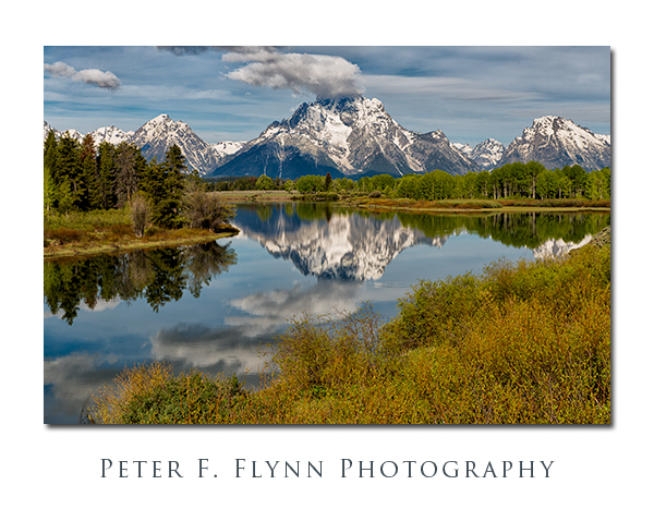
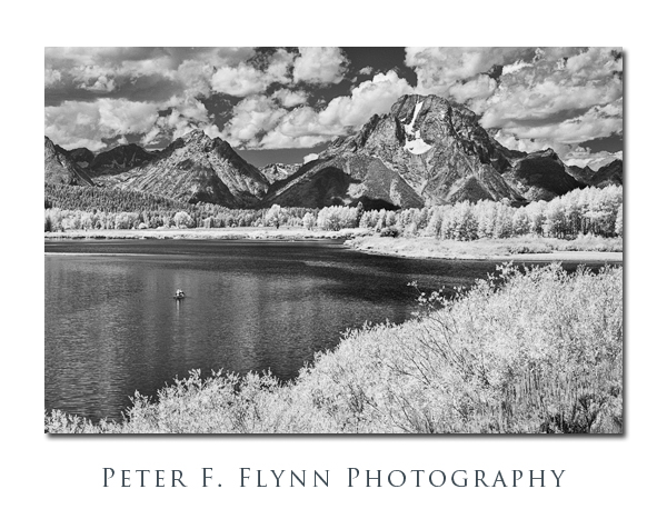
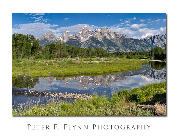
A big advantage of staying at the Jackson Lake Lodge is that it is only a few minutes from Oxbow Bend, making it relatively easy to photograph Mount Moran from across the Oxbow Bend of Snake River at dawn. The image above was recorded at 08:35 MDT (yeah, we arrived late the previous evening so the dawn thing was not happening) on June 1 , 2012, using the Nikon D800E and the AF-S NIKKOR 24-70mm f/2.8G ED lens at 70mm. Exposure was f/11.0 and 1/160s, ISO 100 (base).
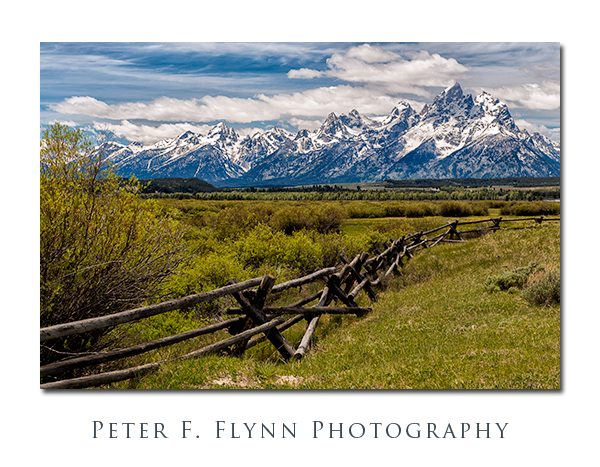
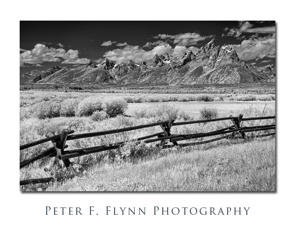
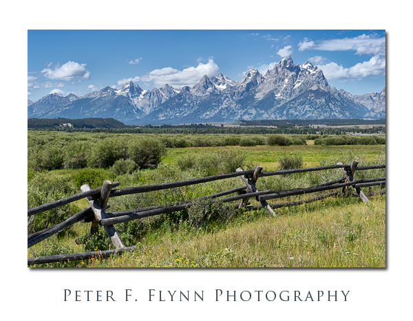
From Oxbow Bend, the most compelling route to explore the park runs N/S along Highway 89 (and concurrently, Highways 191 & 287). Traveling south from the Oxbow Bend, you will first run east to the Moran Entrance, and then track dead south. The first major stop along Highway 89 will be the Cunningham Cabin area. The site consists of two buildings located on several acres. A buck-and-rail fence runs east-west along the southern edge of the site. As you can see in the image below, the fence provides a nice foreground element to the image of the Tetons.
The name buck-and-rail derives from the characteristic X-shaped ‘crossbuck’ or ‘buck’ and long horizontal sections or ‘rails’. Buck-and-rail fences are common throughout this part of the country. The popularity of the style derives primarily from the fact that no post holes need to be dug. The abundance of Lodgepole Pine trees in the region, which grow to produce specimens with trunks that are narrow and straight, insures a ready source of fence stock.
The image above was recorded just east of the cabin at 12:47 MDT on June 1, 2012, using the D800E and the 24-70mm lens at 70mm. Exposure was f/11.0 and 1/160s, ISO 100 (+0.33EV, corrected in post-processing).
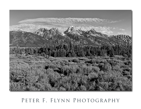
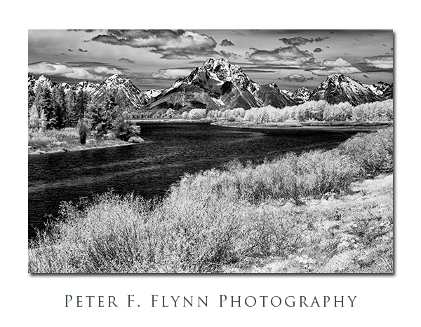 An observation I have made on a number of previous occasions is that infrared imaging provides a very entertaining option for the motivated photographer. Early summer in Gertie presents many such opportunities. The image above was recorded at 11:46 on June 1, 2012, using the Nikon D200IR (converted to 830nm cutoff by LifePixel Inc) and the AF-S DX Zoom-NIKKOR 18-70mm f/3.5-4.5G IF-ED lens at 60mm (90mm effective in FX). Exposure was f/16.0 and 1/10, ISO 100.
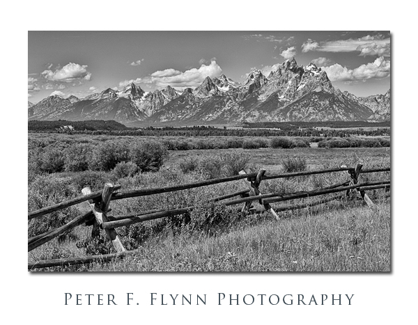
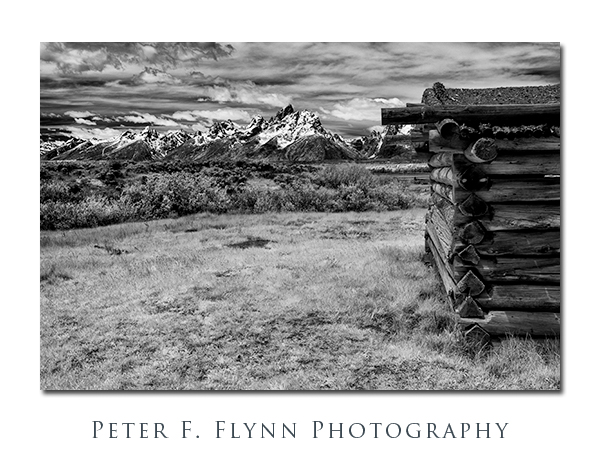 Retracing our steps brings us back to the Cunningham Cabin area at around noon:30. The image above was recorded using the D200IR and the 18-70mm lens at 40mm (60mm effective in FX). Exposure was f/14.0 and 1/10, ISO 100.
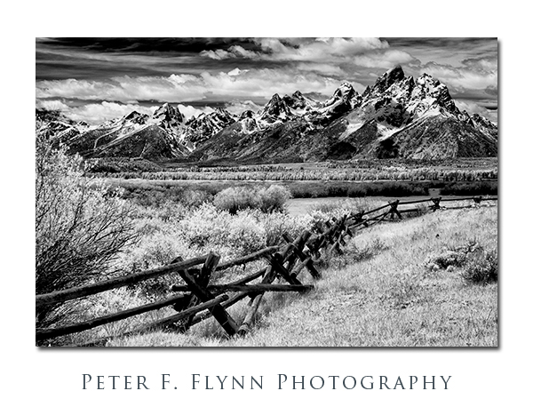 The image above was recorded using the D200IR and the 18-70mm lens at 75mm (90mm effective in FX). Exposure was f/16.0 and 1/10, ISO 100.
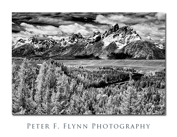
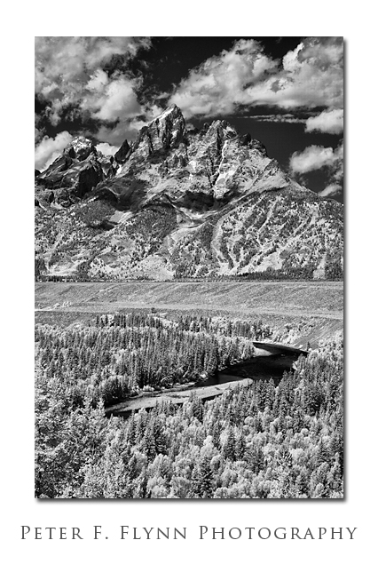
Traveling further south brings us to the famous Snake River Overlook (below). Many have noted, some with lament, that the trees have grown tall since Ansel Adams made his famous image here in 1942. I disagree with those that find the changes problematical, and suggest that a well-made image from here (today) can be just as compelling as those made by the master 70 years ago.
The image above was recorded at 13:09 on June 1, 2012, using the D200IR and the 18-70mm lens at 57mm (90mm effective in FX). Exposure was f/16.0 and 1/10, ISO 100.
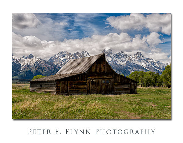
The region south and east of the Snake River Overlook is known as Antelope Flats. We have not seen many antelope (pronghorn) around, but the area is very popular with bison, and we have seen moose near Ditch Creek. A short drive east along Antelope Flats Road brings you to Mormon Row and the famous Moulton Barn shown below. The gambrel-style barn structure has a timelessness to it that many find interesting – many are surprised to learn that the barn was used by the Moulton family until 1945.
Image above recorded at 14:07 MDT on June 1, 2012, using the D800E and the 24-70mm lens at 55mm. Exposure was f/11.0 and 1/125s, ISO 100.
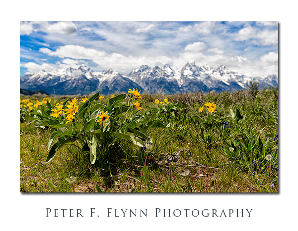
In early summer Antelope Flats is decorated by brilliant yellow Mule’s Ears (Wyethia). The image above was recorded at 14:24 MDT on June 1, 2012, using the D800E and the 24-70mm lens at 42mm. Exposure was f/5.6 and 1/2000s, ISO 400. Handheld.
After passing through Moose Junction we headed back north along the Teton Park Road, which tracks much closer to the Teton Range. Just north of the Taggart Lake Trailhead, we found that the River Road was open. On previous visits, the road has been closed. There are a number of interesting things to see along the River Road, but it is the unique views of the Snake River that I find most compelling. Below we find the HP; with her ever-present field glasses, along the western bank of the Snake.
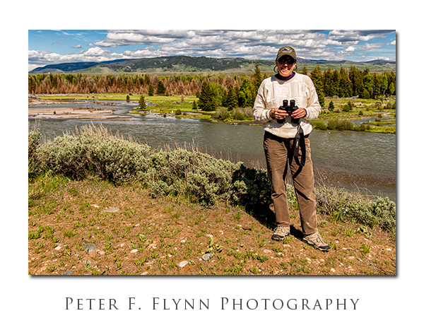 Image above recorded at 16:27 MDT on June 1, 2012, using the D800E and the 24-70mm lens at 32mm. Exposure was f/8.0 and 1/320s, ISO 100. Handheld.
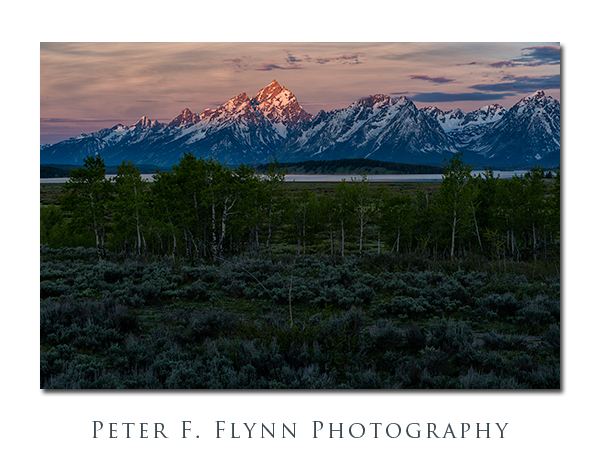
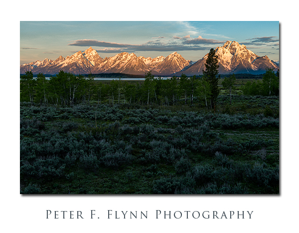
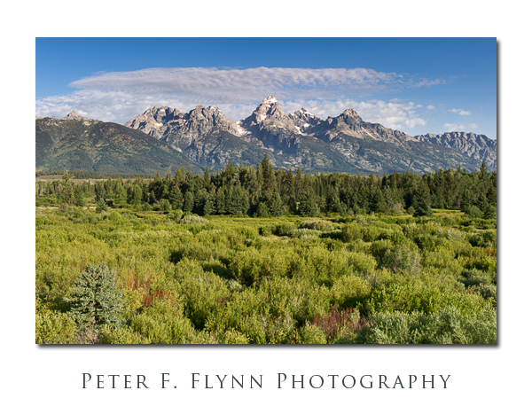
Having recovered from a previous late arrival on the evening of May 31, we were ready for an early start on June 2. The images above and below of the Tetons looking across Willow Flats we made at 05:44 MDT (above) and 05:52 MDT (below) using theD800E and the 24-70mm lens at 70mm. Exposures were f/11.0 and 1/10s (above) and 1/15 (below), ISO 100 (-2.33 EV).
The image above was recorded at 05:52 MDT on June 2, 2012, using the D800E and the 24-70mm f/2.8G ED lens at 70mm. Exposure was f/11.0 and 1/15s, ISO 100 (-2.33 EV).
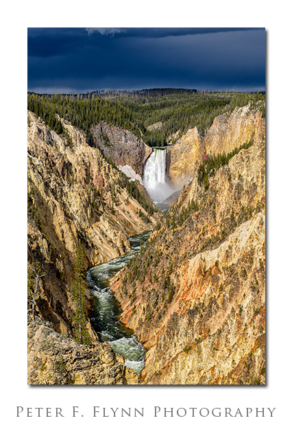
Quite often, during a visit to Gertie, we will make a dash up to The Stone. A visit to Artist’s Point overlooking Lower Falls and the Grand Canyon of the Yellowstone River, shown below, is a favorite spot. I have a few other things to share about our visit to YNP on June 2, but that will have to wait for a future entry.
Image above recorded at 09:24 MDT on June 2, 2012, using the Nikon D800E, and the AF-S NIKKOR 24-70mm f/2.8G ED lens at 70mm. Exposure was f/11.0 and 1/125s, ISO 100.
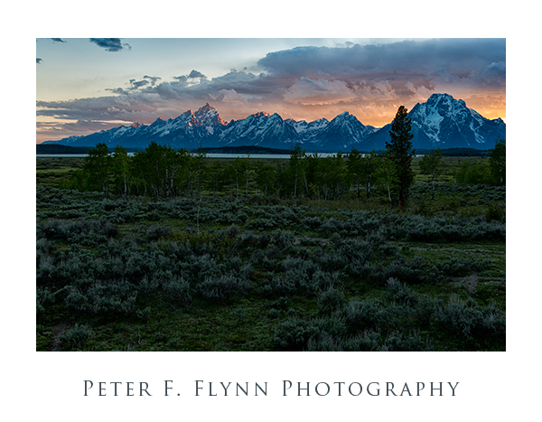 Finally, we returned to Willow Flats in time to catch the sun setting over the Teton Range. When the atmospherics are right, as shown here, the back-lighting of the Tetons can be properly dramatic. Image above recorded at 20:48 MDT on June 2, 2012, using the D800E and the 24-70mm f/2.8G ED lens at 40mm. Exposure was f/8.0 and 1/13s, ISO 100 (-2.0 EV).
Copyright 2012 Peter F. Flynn. No usage permitted without prior written consent. All rights reserved.
