Posts Tagged ‘Utah’

Kachina Natural Bridge

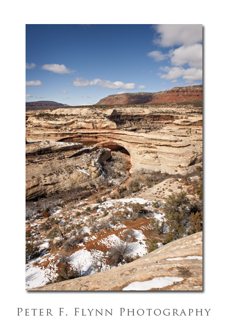
Kachina Bridge

Kachina Bridge lies between Sipapu Bridge to the north and Owachomo Bridge to the south in Natural Bridges National Monument.  Kachina is a Hopi word that refers to spiritual characters – Hopi Kachina dolls are made to represent one of the specific spirits.  The span of Kachina Bridge has been reported by Wilbur and Shelley to be ~192 ft.

The image above was recorded on 2/14/2009 at about 14:00 MST (UTC-7) using the Nikon D700 and the AF-S NIKKOR 24-70mm f/2.8G ED lens at 24mm.  The exposure was f/16 at 1/200s with an ISO of 200.  White balance was set using the WhiBal card, except that instead of the indicated tint of -14 (color temperature 5700 in ACR5.2) I used -4 to prevent the sky and snow from becoming too cyan (green).

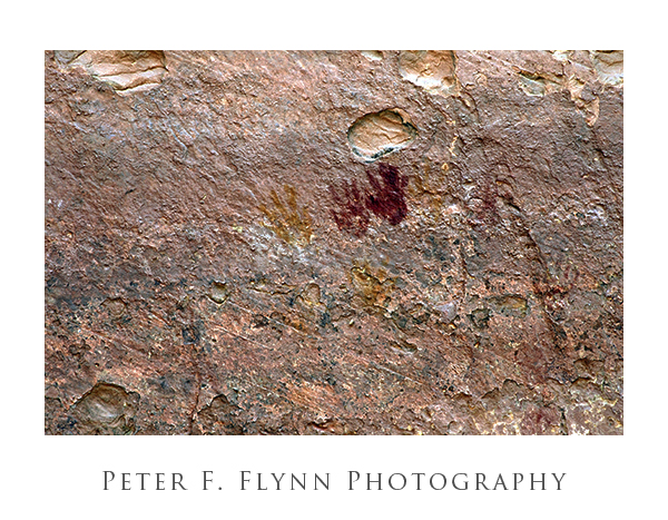
The bridge was named for the rock art that adorns the eastern and northeastern faces of its base, and a false color image of a portion of the Kachina Bridge pictography is shown below.  Hand prints are a common signature element of rock art in the region.  This image was recorded in the summer of 2006 using the Nikon D70s with the AF-S Zoom-NIKKOR 18-70 f/3.5-4.5 IF-ED lens.
Kachina Bridge Pictograph

Sipapu Natural Bridge

Sipapu Bridge

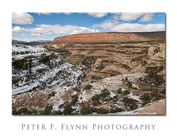
Sipapu Bridge is the northern most of the three major bridges in Natural Bridges National Monument.  The bridges were discovered by a miner named Cass Hite in 1883.  Sipapu is a Hopi word that means ‘place of emergence’.  Bridges are the result of erosion due to water flow, and these structures are distinct from arches that are formed by freeze/thaw action and seeping moisture.  The bridge is almost directly in the center of the image.  In real life as here, it can be a little difficult to discern the bridge.  Sipapu is one of the world’s largest bridges, with a span of ~225 ft and a height of ~144ft. For more information on Sipapu and other natural bridges and arches, check out the web pages of the The Natural Arch and Bridge Society and UtahArches.com.

The image was recorded on 2/14/2009 at 13:00 MST (UTC-7)with the Nikon D700 and the PC-E NIKKOR 24mm f/3.5D ED set at -6 mm shift.  Exposure was f/16 at 1/125s with an ISO of 200.  White balance was established using the WhiBal card and was set in ACR5.2 at a color temperature of 5700 and tint of -14.

Canyonlands

An excellent visit to the Utah canyonlands!  This time of year the weather is pretty unpredictable, but if you are willing to risk the venture the rewards are great (see the February 14th entry).

Based on last minute forecasts, we decided to commit to the canyonlands area.  Nevertheless, we headed south towards canyonlands on Friday morning with little promise of decent weather.  Light traffic on I15, light also on US6, and I70 was a ghost highway. With sketchy forecasts for the following morning we decided to camp in Moab.

The original plan was to hike Natural Bridges NM, one of my favorite areas anywhere.  Saturday morning was beautifully clear and we decided to have  a go at our target.  The road south was dry and clear to just north of Monticello.   Here we encountered snow blowing across the freeway, and these conditions persisted through to Blanding.  US191 lies to the leeward of westerly winds blowing across the Abajo Mountains and these peaks  control the local weather.  Fortunately, the conditions improved as we headed west towards the monument along UT95.

NBNM doesn’t get many visitors this time of year and the parking lot of the visitor’s center was empty except a couple of park service vehicles.  The ranger was friendly, but had some bad news.  Unfortunately, most of the trails down to the floor of the canyon had several inches of snow on them making them impassable.

We did manage to scope all three of the major bridges in the park: Sipapu and Kachina from the view points, and Owachomo by hiking beneath it.  Stay tuned for photos from NBNM coming soon.

We spent today, Sunday, in Dead Horse Point State Park and in the Island in the Sky unit of Canyonlands.  A beautiful morning.  Light clouds appeared about mid morning, which thickened significantly during the day.  Had a go at reaching False Kiva.  Look for photos in the next couple of days.